Rhode
Island, Connecticut, New York, New Jersey:
September 12 – October 6
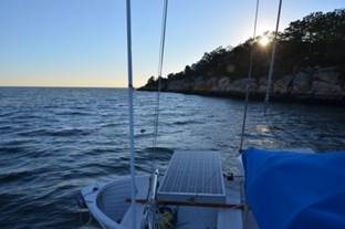
Dutch Island Harbor, RI. Sept 12. We sailed the 30 miles to Rhode Island from Cuttyhunk Island on Vineyard Sound. The seas were high, 4-5 feet, but not as challenging as in the Vineyard Sound. The weather was very warm and humid, so there was a murkiness to the sky and visibility was not great. We had forgotten the challenges of sailing on a heel ... something we have not done this season until today. Below decks everything has been rearranged. It felt good to sail all day, and the wind generator kept us topped up for the most part.
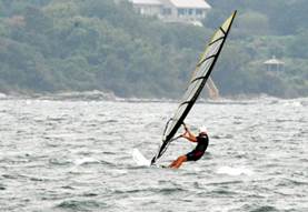
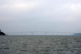
Some folks love the high winds Poor visibility and our first bridge
Friday we stayed at anchor in Dutch Island Harbor watching the thunderstorms around us. We did get some rain, but not much. In the afternoon the wind backed to NW and the air became cooler and less humid. A welcome change. There were 3 other boats anchored just outside a large mooring field, and they stayed anchored for the day. Because of the impending thunderstorm we were not inclined to take the dinghy ashore.
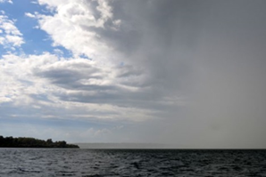
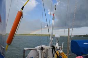
Left side clear and sunny, right side downpour Rainbow after the storm
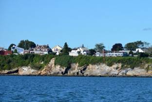
Dutch Island has some ruins of a fort, but is not inhabited and dense with underbrush. The houses and a trailer park were on Conannicut Island, a much larger island in Narragansett Bay.
Trailer Park Boys A cat snack if only we had a cat
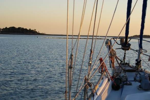
Stonington, CT. Sunny with NW wind at 10 knots. It was going to be perfect for our sail to Stonington, 18 miles to the west. The sail lasted less than an hour. The wind dropped to almost nothing, and the motor came on. After noon, the wind slowly began to build, up to 15 knots, but from the west, so sailing was out of the question if we wanted to get into Stonington before nightfall.
The Rhode Island shoreline from Narragansett Bay to Connecticut is one huge beach with no harbours. We saw a huge Ferris wheel from several miles out, and understand there is also a famous carousel in the same location. Stonington is the eastern-most Connecticut port, and reported to be the only one in the state with a commercial fishing fleet. However, we saw what appeared to be commercial fishing boats as far west as Norwalk. Our daughter sent us an article about the Connecticut lobstermen agreeing to a curtailment of the lobster season, but there were still plenty of floats in Connecticut waters. We did not even know there was a lobster industry in Connecticut. The article said that warmer waters had forced the lobsters further north, but we also know that the current price for lobster off the boat is very low from Canada south to Massachusetts.
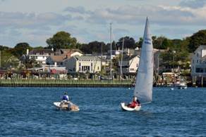
Dinghy training in Stonington Harbour Stonington from the anchorage
Stonington is a very attractive village as seen from the anchorage. There are the traditional clapboard houses and very tasteful modern houses. The boats range the gambit ... a 5-spreader racer moored near us (Mischievous, USA 50065 ... does not have a great racing record), a 25-foot gaff-rigged lapstreak sailing dinghy, a J-160, and your usual east-coast yawls.
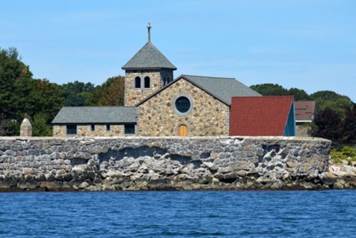
Mischievous, USA 50065 Interesting church building in Stonington
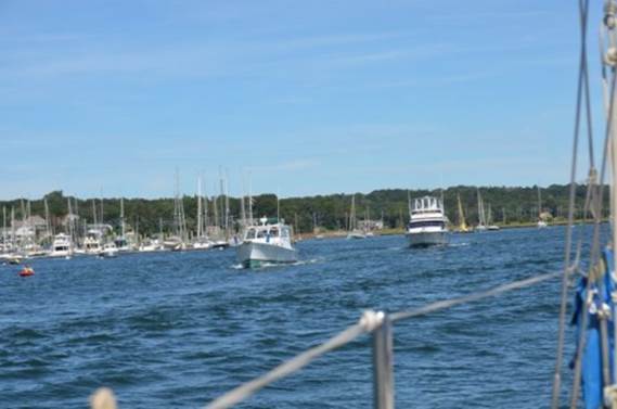
Mystic, CT. It was a very short motor trip from Stonington to Mystic amid a conglomeration of boats, many on moorings and docks, and a goodly number sailing or fishing. Mystic is about 2 miles up the Mystic River. The river is a buoyed channel that is fairly narrow in some places, and the depth drops to silted mud 5-foot depths while still inside the buoys. With boats coming and going, some under sail, it was a bit nail-biting, especially when we got to the swing RR bridge which we were informed is supposed to be open as a rule. We later learned that 37 trains are scheduled to go over the bridge every day. It did not help our anxiety that the bridge operator was not answering calls on the radio. But, as we approached the bridge, it opened. We docked at 2PM at the Seaport Marina, just downstream of the bascule road bridge.
Rush hour in Mystic
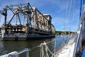
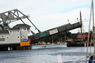
The magic opening bridge One bridge we did not need to go under
We spent an entire day at the Mystic Seaport Museum, and that was not enough to see everything. They have 4 large boats, one under reconstruction, and many small dories and sailing dinghies. The Charles W. Morgan was a whaling ship under major reconstruction, including new spars and rigging. It was launched in 1841. The decks have been re-tarred, the spars and rigging are being constructed from scratch, and the below deck area is being finished to show the crew's quarters and the rendering plant. The museum has a large preservation shipyard with live oak from the south being seasoned for use in the Charles W. Morgan. They also have modern equipment with which to make authentic hardware. The L.A. Dunton is a fishing / racing schooner (competed against the Bluenose, but Mystic does not disclose the outcome of the race: that the Bluenose won) of the classic 19th century style that was built in 1921. Much of this boat is open to see. The Joseph Conrad is a full-rigged square-rigger built in 1882 in Copenhagen as a training ship. Today her below-decks is mainly used in the junior sail program and her main deck is open to the public. During Hurricane Sandy last October the museum almost lost the Joseph Conrad; the land-base to which she was secured was not sound. The little boats ran the gambit from rowing / sailing dories for fishing, sailing dinghies for racing / pleasure, whaling boats that were carried on large ships like the Charles W. Morgan.
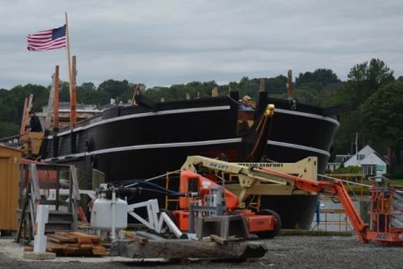
Charles W. Morgan undergoing a refit
Under the cover of a building, a half-decayed schooner has had parts stripped away to reveal the underlying ribs and planks of an old schooner.
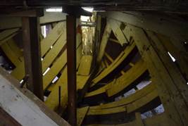
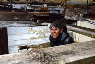
A schooners innards Jane inspecting the workmanship …. Needs tidying up
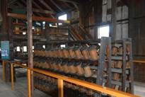
One of the major attractions of the museum is a re-constructed fishing village as it may have appeared in Mystic between 1850 and 1870. There is a model of the Mystic River (helps set the stage for the reconstructed full-sized village) and then buildings depicting a lobster shack, a life boat station, an oyster house, a salmon shack, a marine railway, a boat shop, a ropewalk (long house where rope was spun), a cooperage, a shipsmith shop, a sail loft and rigger's shop, a nautical instrument shop, shipcarver's shop, as well as a school, chapel, house and drug store. Many of the houses were staffed by volunteers and/or staff who have historical knowledge how the shop/ establishment was run. The shipsmith shop was the most interesting and helpful.
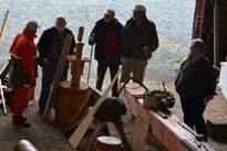
Rope walk still in use Lecture on the building of a dory Museum grounds
There were also a number of exhibits designed for children, which we skipped, a display of figureheads (the Isles of Scilly had a larger display, but then think of the number of shipwrecks they had on their shores), and a typical museum exhibit, "Voyages: Stories of America and the Sea."
It was well worth a day's visit. We were a bit surprised that there was virtually no mention made of the Canadian Maritimes, since they were so closely linked in the 19th century.
The Thimble Island, CT.
The Thimbles are just east of New Haven ... about 25 islands, some with summer homes (BIG ones). We anchored in the Thimbles in 2006 and found it to be quite pleasant. This year was a different matter. There were more moorings, making anchoring space scarce. It was also a full moon, so the tides were high and the currents were strong. The winds were from the SW, and the anchorage was open to a 2-foot swell that rolled into the anchorage between 2 islands. In addition, when the tide turned and the flood began, there was a 2+ knot current that turned our stern into the wind, causing us to swing through about 80-degrees with no pressure on the anchor, but 2-foot waves breaking on the stern. It was not a restful sleep night.
Lovely summer home we anchored beside The lovely rock wall was on the other side
Norwalk Islands, CT. We left early from The Thimbles to catch a favourable westward current. We got to the Norwalk Islands at noon and picked our way through the shallows at high tide to an anchorage that is mainly sheltered by drying rocks. At low tide, it is very comfortable. At high tide, if there is wind from the SW it may not be as comfortable without the drying rocks buffering the waves. This is not a recommended anchorage, but it served us well along a coastline that has few anchorages left.
The shoal was not visible until low tide and limited our entry into the bay
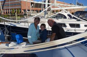
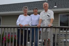
Stamford, CT. The major attraction of Stamford is its close proximity to Darien, home of our daughter, son-in-law and 2 grandchildren. We left the boat in a marina and spent time on land. We had a good time with the family over the weekend. Our daughter was involved in a large fund-raising event on Saturday and was involved with the clean up on Sunday morning. The event was a success raising more money than planned for a local food bank. Despite the weekend activities, the kids made 2 visits to Pilgrim. The kids loved going up and down the ladders from the cockpit to the cabins. We think our grandson was a bit disappointed with the diesel engine (he thought it would look like a diesel train engine), but was thrilled to learn how to look through binoculars. Our granddaughter quickly figured out how to get to the toilet paper in the waterproof container in the head and was fascinated with the forward head which has TWO doors (for such a tiny room). We had full run of their laundry facilities and car to do provisioning. MANY THANKS.
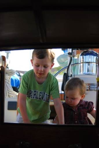
Grandkids inspecting Pilgrim
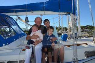
The grandkids first visit to Pilgrim
Oyster Bay, NY. With a lovely, moderate W/NW wind we sailed 10 miles across Long Island Sound due south to Oyster Bay. This is a well-protected, large bay with anchoring room outside the large mooring fields. There is no swell, and except for the train whistles it is very quiet. Our plan was to go down the East River from Long Island Sound and around the southern tip to Manhattan (The Battery). The currents in the East River just as it hits Manhattan north of Roosevelt Island are legendary. We studied the tidal currents for the East River to ensure we could make the transit with a favourable current and get to an anchorage before sundown (6:45 PM).
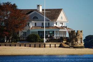
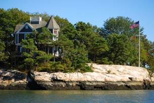
Traditional oyster gathering using long rakes Spectacular summer homes
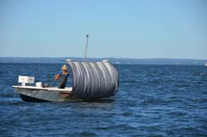
Oyster Bay still has wild oyster-harvesters. These folks use shovels with handles up to 20 feet long to scoop up sand from the bottom where the oysters live. It is fascinating to see the harvesters work with these unwieldy shovels. Theodore Roosevelt spent some summers in Oyster Bay and his "Long Island White House" still stands as a restaurant / museum.
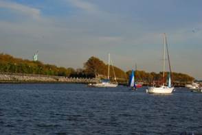
Liberty State Park, NJ. We left Oyster Bay at 10AM. There was no point leaving earlier, since we would have been fighting adverse and dangerous currents in the East River between Long Island Sound and Manhattan (just north of Laguardia Airport). It was comforting to see other boats aiming for the Throgs Narrows with us. We went under the bridge with 3 other sailboats, and only had half a knot of adverse current. The trip through the East River just north of Laguardia is not picturesque, but there is drama from the airplanes taking off right overhead. There was no commercial boat traffic. Because the UN was in session, the river just south of Hell Gate was restricted (as it was in 2006 when we made the same passage). The easier, wider passage west of Roosevelt Island passes the UN buildings. We were forced to use the passage on the east side of Roosevelt Island, which requires a lift bridge to open. Even with 5 boats queued up to go through, the bridge operator was sluggish. It was after 3PM and the current had finally gone through slack and was in our favour ... 2 knots in our favour and carrying us toward the bridge that would not open. Needless to say, it finally did open and we all began breathing again, but only temporarily. We had forgotten how difficult the lower East River can be with its high speed catamaran ferries (28 knots), coast guard boats with machine guns mounted on the bow, NY Fire Department RIBs racing down the river at full speed (and full wake), the huge orange and black Staten Island ferries, the water taxis, the tourist cruise boats, and the endless low-flying helicopters. We realized we had not studied the Collision Regulations regarding right of way of helicopters and boats. The helicopters do not take off vertically, but horizontally and skim the top of the water for several hundred feet before rising. The water turbulence from all this activity caused poor Pilgrim to spill many items from bunks, shelves, etc. The pots and pans were a jumble in the pot locker. As we approached the Statue of Liberty after 4PM and realized that to get to the anchorage on Staten Island was 2+ hours away (sunsets at 6:45PM) we knew it was prudent to go to the Liberty State Park basin where we anchored in 2006. Back then, we were the only boat anchored there. A couple of coast guard RIBs passed us and waved, but no other boat entered. NOW, there has been development on the western shore of the basin, there is a sailing club headquartered in the basin, and there were 3 other boats already at anchor when we arrived. There was still room for us, but after us 2 boats from Montreal and one from Germany joined us. Thankfully there was no wind. The constant buzz from the city and passing helicopters was not enough to keep us from sleeping.
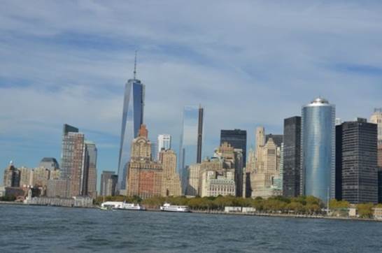
2012 New York Skyline
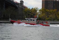
Fire Dept RIB creating a huge wake Anchorage behind the Statue of Liberty
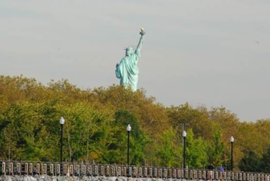
View of the statue from the anchorage
Manasquan Inlet, NJ. We started our trip down the NJ coast. This coastline is difficult. It is basically one huge barrier island with several widely-spaced inlets to allow boats to get to the "inside passage." Our friends live on Barnegut Bay, about half way down the NJ coast (60 miles south of NYC). It takes about 1 hour to travel a winding buoyed channel from the inlet to their house. Jane found Shark River as a potential half-way anchorage / marina between NYC and Barnegut Bay, but after we began our trip down the coast, we discovered there is a fixed bridge 50 feet high that we could not get under between the ocean and the marina. We looked at other options, and the only one that was available was Manasquan Inlet. Fortunately there is a marina here that could accommodate us for the night, provide diesel and a pumpout. The fuel was not as inexpensive as we had hoped (but of course, less expensive than in Canada), and the dock charge was on the high side, but we had a safe berth for the night. Yachting is certainly a power boat / fishing sport in New Jersey. There was one other sailboat at the marina.
Barnegut Inlet, NJ. We tied up behind Winsome, our friend’s C&C 36, for a week to make a number of repairs. Our friends live in a lagoon village. Each house has a street at the front of the house and a lagoon running along the back of the house. Many have boats, mainly sport fishing runabouts, but several sailboats. Our friends were out of town for the weekend, but had arranged for their friends to be on hand to ensure we made it in without going aground. Places in the inlet are shallow and one navigation aid was put in the wrong place and caused over 30 boats to ground this summer.
The sail from Mannaquan to Barnegut was a bit wild. First, the current in Mannaquan was very strong and pinned us to the pier where we spent the night. We had hoped to get an early start but low tide was 8AM and the ebb current was too strong to fight. We finally left at 9AM with only minor scratches to the dinghy bow fender. The wind was still from the north, around 15 knots. Since our course was due south, the north wind was better than a head wind, but the 2-3 foot waves kept knocking the wind out of our sails, and we ended up motor-sailing the 20 miles down the coast. Since we were only 2 miles offshore, we could see the destruction from Hurricane Sandy, but were surprised how little there seemed to be. Most of the buildings have been repaired / rebuilt. We witnessed the remains of a fire that destroyed an amusement park / board walk at Seaside Heights. It has just been reconstructed after Hurricane Sandy when the fire broke out.
Getting in the inlet was a bit of a challenge with the waves and wind blowing broadside. Our chart plotter did not include all of the navigation aids in the area, and with only 2-3 feet of water outside the channel, we had to be quite vigilant. As we approached the channel to our friend’s lagoon, we discovered the Beneteau waiting to shepherd us in, and another friend waiting at the entrance of the lagoon to ensure we went down the right "alley" and to help us tie up. Later in the afternoon the Beneteau owner came over and invited us to dinner. We have been invited to the local yacht club Sunday lunch. In short, we were wined and dined that we could easily have forgotten about the repairs that needed to be done.
Besides basic maintenance, such as washing down the decks and enclosure windows, laundry and provisioning, we needed to clean the starboard water tank and investigating why our fuel gauges were not working. We found two problems with our fuel system: a blockage in one hose in the fuel polishing system that made it seem like there was no more fuel in the tank and malfunctioning senders (fuel sensors) in each of the 3 tanks. Both have been fixed / replaced. The problem with the propeller shaft was much more extensive than we first thought. Having Jim's workshop, tools and experience were invaluable. Today a passing swimmer in the lagoon checked out the zincs on the prop shaft and reported they were missing.
We received delivery of a new battery charger. Back in 2009 we had a number of major problems with our electrical system. We speculate that we were probably hit by lightning when we were on land in Sweden. In Wismer, Germany our 110V charger died and we replaced it with a 220V charger that only had a 20 amp output. The Honda (gasoline) generator produces more than 20 amps, but we could only charge at 20 amps/hour. This meant It took a long time running the generator to top up a 100 amp deficit. We now have a 55 amp charger and it is installed and working very well on shore power. We will check it out with the Honda in the Chesapeake.
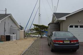
Cars in the front and boats in the back, Jim and Linda have a great home and workshop
Reedy Island, Delaware River, DE A week after we arrived, we left our friends’ dock at 11AM. We had considered putting into an inlet and breaking the trip to the Chesapeake into 3 day- trips, but the safest inlet is at Cape May and the Inlet has a front door on the Atlantic Ocean and a back door into the Delaware Bay, but there are 2 fixed bridges over the Cape May Canal with 55 feet of clearance. We require 62. So, we decided to make the run from Barnegut Bay to the entrance to the C&D Canal (130 miles) as an overnight. We timed our departure so that we would be at the entrance of Deleware Bay at low tide and ride the flood current up the bay and river. We actually sailed down the NJ coast for several hours until the wind died at sunset. When the wind died we were joined by a phoebe. We had been inundated by flies during the afternoon and a number of swatted bugs were on the decks and in the cockpit. The phoebe dutifully ate every one and caught some live flies as well. The bird actually joined us in the cockpit and jumped on Brian's knee and foot. In the morning the bird was still on our aft deck; we suppose s/he had found a refuge on the lee side of the boat.
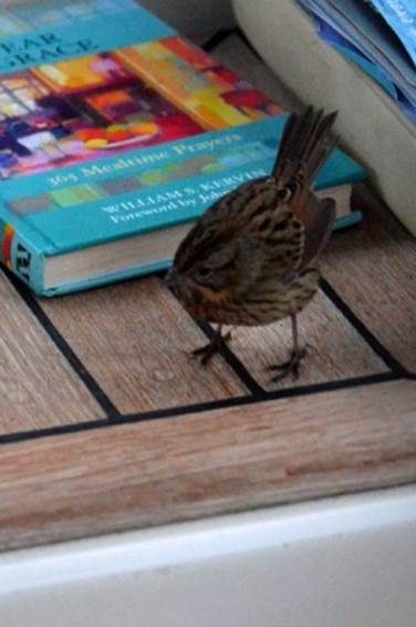
Our resident fly catcher
Around 9PM the fog descended, so we had all instrumentation on helping us see obstacles. By midnight we could see stars above the mast, but could not see navigation aids a quarter mile away. Even daybreak did not burn off the fog. It was not until we were anchored in the afternoon that the sun broke through and the air temperature rose with little wind to give us relief. This anchorage is behind a low island of reeds, which offers little wind protection. There is a sunken breakwall that gives some protection from waves, but the 2.5-3 knot current rips through the anchorage, deciding which way our bow turns. When the wind is strong from the south, but the current is keeping our bow pointed NW, the ride is a bit bumpy
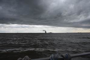
The second day was a bit nerve-wracking. We knew thunderstorms were in the forecast and with strong southerly winds, we had no intention of moving, but on Monday morning the radio alerted us to a tornado-watch for our area. We prepared for a big blow, taking down flags, wrapping the main and mizzen sails with extra lines, tying off the furling sails, removing anything that could move from the decks, and listening to the radio. We decided against deploying a second anchor since we were subject to a very strong ebb and flood current that turned the boat 180 degrees and we did not want to risk twisting two anchor rodes around each other. We were in the flood current, keeping the bow pointed south, when the strongest blasts from the south hit us at 30 knots.
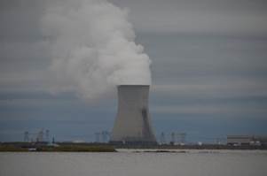
Reedy Island town and the nuclear power plant across the river
The anchor (yes, the new Rottweiler anchor) dragged, and we had to re-anchor. With both current and wind against us, it took all the RPM's our engine could muster, motor-tacking to get us further south in the anchorage to drop it again. Even with us in forward idle, we slipped along the bottom for 150 feet before the anchor bit in. Then for the next half hour we kept the maximum pressure off the anchor by keeping the engine in forward idle. The good news... there was not a tornado and no lightning. There was plenty of wind followed by rain. We saw 2 sailboats going up the Delaware River towards the C&D Canal; we think they felt it was safer going into the canal than trying to negotiate the narrow entrance into the Reedy Island anchorage to take refuge. Some of the barges and cargo ships anchored in the Delaware River were having difficulty keeping their anchors from dragging, based on overheard radio traffic. The good news is that the cold front arrived bringing us cooler and drier air.
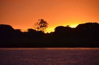
High winds with a tornado warning “Red sky at night, sailors delight” we hope
The third day we made the transit of the canal with no problems. There was no commercial traffic and only 2 sailboats going eastbound and 1 going with us westbound. There were a few powerboats in each direction.
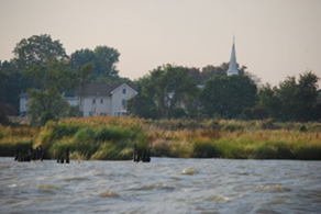
Our first Chesapeake anchorage was in the Sassafras River on the eastern shore of Maryland. We were anchored close-by in 2006, and despite strong northerly winds in the bay, it was calm up the river. There were 2 duck blinds in the little bay where we are anchored, and the ducks and geese competed with each other for the loudest quack prize. Note to selves: Check out when duck hunting season begins, and anchor prudently.
Our Chesapeake Cruising log and photos will be posted later in November.