The Chesapeake, October 8 – November
2, 2013
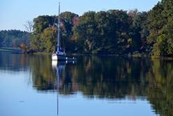
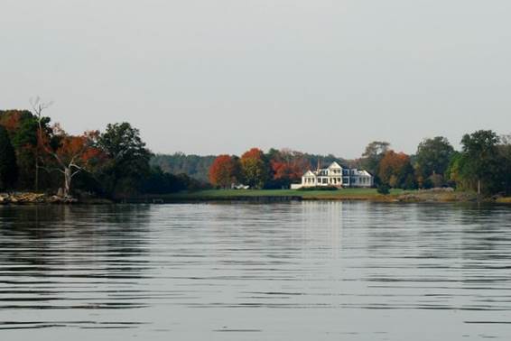
Sassafras River, on the eastern shore of Maryland in the north section of the Chesapeake. There are 2 duck blinds in the little bay where we anchored, and the ducks and geese competed with each other for the loudest quack prize. We remember the number of blinds and the flocks of geese and ducks from our cruise in the Chesapeake in 2006. We decided to check out when duck hunting season begins, and anchor prudently.
During our month in the Chesapeake there were several wind advisories, usually for northerly winds gusting to 30 knots.
Gibson Island, Magothy River, on the western shore of Maryland between Baltimore and Annapolis. We sailed down the eastern channel, and then cut across to the western shore in 15 knots of wind from the north. There were only 3 power boats and one catamaran out in addition to 2 tugs, one with a barge, and a coast guard buoy tender. Most cruising boats were hunkered down. The visibility became very poor during a down pour, but was fair during the light rain. The most harrowing time was getting in the narrow channel at the mouth of the Magothy River, with wind and short choppy 2-foot waves on the starboard quarter. We had a double reef in the main and the staysail, which was about as much sail as we could handle with the wind and wave conditions.
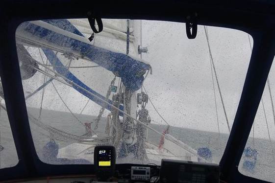
The Chesapeake always seems to greet us with high winds and high seas
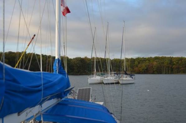
We anchored in Eagle Cove on Gibson Island, opposite a horse farm and stayed 4 nights waiting for improved weather. There were always other boats in the anchorage, but they came and went while we stayed. Sunday night was somewhat nerve wracking. 5 sailboats showed up about the same time; 2 of them attempted to anchor with no success. We think the boats might have been part of a cruising instruction program, since there was very little anchoring savvy shown. The boat with the most promising anchor (a Delta), dropped the anchor and backed so hard that there was no way the anchor would set. Another boat had a lightweight Fortress / Danforth anchor that just jiggled along the bottom. Finally the Danforth anchor caught, and the boat with the Delta tried to raft off the Danforth boat, and they both of them slid across the bay. After another 3 tries, the boat with the Delta seemed to get a set. Then the boat with the Danforth decided to deploy their anchor and slowly drifted back on the Delta-anchored boat and rafted against them. Then a 3rd boat deployed their anchor and very very slowly drifted back to join the raft. 3 boats with 3 anchors deployed and rafted together: a disaster in the making. BUT...then the other 2 boats circled around us several times One anchored about 4 boat lengths off our starboard bow, backed and seemed to get a set, but their stern was just 50 feet off our bow. The other boat dropped their anchor off our port bow and backed over our rode. They were about 2 boat lengths off our port beam. Fortunately no one dragged, but the wind had lightened. When we left the anchorage we had to ask the boat on our port side to move up on their rode so that we could bring up our anchor. We think the bottom is mainly clam shells with a thin layer of silt, which is why it is so hard to get an anchor to set.
These folks gave us a
great demonstration on how not to raft
Emory Creek, Corsica River, Chester River, on the eastern shore of Maryland. The wind was still from the NE, but only 10-12 knots; the seas were still a choppy 2 feet. We motor-sailed across the bay, and finally did a bit of motorless sailing into the Chester River. The mouth of the Chester meanders, and there are fish weirs in the shallows, so favourable wind was short-lived and the motor was on more than off. We are surprised at the relative lack of crab pot floats and watermen out tending their crab lines. There are no oyster-harvesters out here. Quite different from 2006.
We had the anchorage pretty much to ourselves. Even the mammoth houses were dark except for lights on timers. We could hear an owl hunting. We saw an osprey and heron, and heard ducks and geese. (We kept saying Happy Thanksgiving to the Canada Geese since it was Canadian Thanksgiving ... at least they were still alive and not on a table.) We heard shotguns fairly often during the day, so it was definitely hunting season.
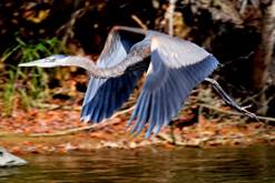
Our first full day at the anchorage was glorious with sunny weather. We rowed the dinghy up Emory Creek. At every turn there was something new: the turkey vultures, ospreys and Canada geese, the invisible owl and woodpecker, the blue jays and kingfishers, the sounds of squirrels (lacking all the way down the New England coast), water snakes, and long thin strands of spider webs reaching from the tree tops down to the water. We did not see any terrapins (turtles) for which the creeks are famous. Brian fished. He caught one small fish which was thrown back into the water. But then, to Brian's amazement, a good-sized catfish went for his bass lure and he landed the fish. Great eating. The crab trap, although deployed twice, has yielded nothing. But then, the watermen we have seen longlining have caught little, and the word is that this is the second year of poor harvest of blue crabs in the Chesapeake.
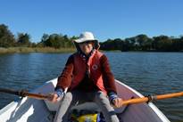
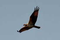
Jane working on muscle tone, Brian catching dinner and an osprey circling
Tilghman Creek, near St. Michael’s on Maryland’s eastern shore.
We motored back out the Chester River (12 miles), down the west side of Kent Island (10 miles) and under the Bay Bridge, then up and around Tilghman Point into East Bay into which the Wye and Miles Rivers flow (14 miles). It was dead calm and threatened rain. The trip was frankly boring. We carefully worked our way into Tilghman Creek. There are 2 green and one red navigation posts in the entrance channel, but the shoaling has encroached on the channel so that you must go within 20 feet of the second green nav aid to avoid an unmarked shoal on the right side of the channel. Our depth sounder which measures how much water is under the keel indicated we were in -.07 feet of water, but we did not hit bottom. Once in the creek there were several coves for anchoring. No other transient was there, so we had lots of space to drop our anchor. It was very quiet, except for the couple of hundred Canada geese, the egrets and an eagle.
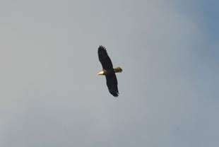
Canada geese organizing the next migration stop Bald eagle hunting
We took the dinghy up the creek to the location of a boatyard no longer in operation. There were a couple of large commercial fishing boats, some crabbing boats, an oyster boat, and a few derelict hulks left to rot on the bottom after being torched years ago. At the mouth of the creek there were a dozen large homes that were obviously used as summer homes (no lights on). Up the creek there was a horse farm, and waterman homes. Interesting, but lacking the magic of Emory Creek.
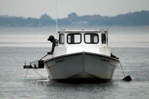
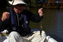
Working the crab line
St. Michael’s on the Miles River, eastern shore, Maryland. We sailed downwind with just the Genoa the 8 miles to St. Michael's. We docked at an Inn/ Marina and were hoping our daughter, son-in-law and their 4-month old son could stay at the Inn, but all the rooms were taken, so they stayed in a hotel in another town 15 miles away. There were only 3 transient boats in this marina our first night, but on Saturday there were 20; almost all the slips are taken. This is a popular destination for weekend cruisers.
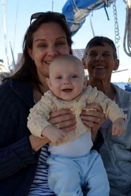
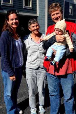
The kids and grandson with a smiling mom
Having our grandchildren visit us on board Pilgrim is a highlight, even when the child is only 4-months old. His mom kept up a constant quiz with him about boat terms, trying to ensure he will grow up an avid sailor.
Dividing Creek, Wye River on the Maryland eastern shore .It was a quick motor trip from St. Michael's to Dividing Creek off the Wye River. We were in Dividing Creek in 2006, and were happy to be back, but it has changed. We anchored fairly far up the creek, but in 2006 we could row at least another half mile around a bend up the creek. Now only 1/4 mile is navigable and then the creek is clogged with reeds. The fall colours are not developed as fully as they were in 2006, and there are many sea nettles, jellyfish with small cylindrical bodies and delicate tentacles that can reach 4 feet in length (and they sting). The first night there were just two other boats, one from New Glasgow, NS. We got to meet the owners ... on their way to the Bahamas. The second night a group of sailors from San Diego who had chartered about 10 boats to cruise in the Chesapeake arrived, along with 4-5 other boats. It was not really crowded, but it did not seem very secluded.
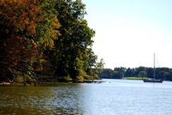
Solitude in Dividing Creek, Wye River
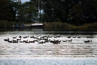
La Trappe Creek, Choptank River, eastern shore, Maryland. We motored most of the way from the Wye River through Eastern Bay back out to the Chesapeake, then south to the mouth of the Choptank River. We were the only boat at anchor in the mouth of the La Trappe Creek, but there were nearly 800-1000 Canada Geese in the waters near us. There were so many birds; the surface of the water had goose down floating on it. There was one house, but no lights were on. Our cruising guide painted a far different picture of the anchorage than we found. It was pleasant enough, but we could not find the trees arching over the creek forming a kind of “‘tunnel.”
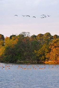
Another V formation joining an already large rest group for the night
St. Leonard’s Creek, Patuxent River, Maryland western shore north of the Potomac River. The trip back to the Chesapeake out the Choptank River was a major uphill battle. The wind was strong from the NW (20 knots) and the waves were steep (2 feet) and choppy. We motor-sailed / tacked our way to the mouth of the river, then had an adrenalin rush sail south to the mouth of the Patuxent River. We had reefed the main, and at one point when the wind died, we considered shaking out the reef. When we put the engine into gear, we heard a terrible grinding sound, and immediately turned it off. The wind picked up, and for the next hour Brian worked on moving the shaft. Finally whatever got caught, freed itself, and we breathed a sigh of relief. We are not sure what caught on our prop shaft, but are thankful it freed itself.
We went the additional 8 miles up the river because the anchorage was rated 5 stars. There were large mansions along the banks, and plenty of internet access points, but all highly secured. Why? The US Navy has a major base at the mouth of the Patuxent River and probably most of the inhabitants in the area are military and know the need to have high security on access points. Was the extra 8 miles worth the trip up the Patuxent? We could have anchored among the marinas in Solomon Island right at the mouth of the river. We would have said NO... the extra 8 miles were not worthwhile, except just as we hauled anchor, two deer swam up the creek, and bounded up the bank opposite where we were anchored.
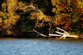
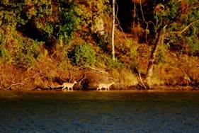
Deer crossing the river to safety
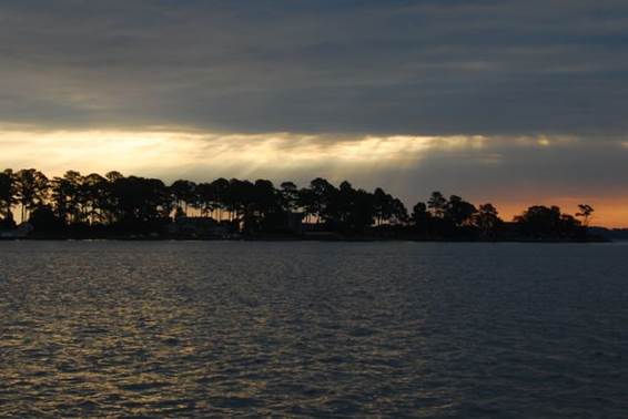
Smith Creek, at the mouth of the Potomac River, western shore of Maryland. We sailed to the mouth of the Potomac River. The sail was mainly south, with a strong (15-20 knots) NW to W wind. Once we got to the mouth of the river, we had to turn NW into the wind and waves (and Crab floats), and slugged our way into Smith Creek. We were delighted with this anchorage. A few houses along the shorelines, and prominent eagle's nest high up in a dead tree, and loons wearing their winter coats, but singing their usually mournful song.
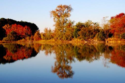
Fall colours at Smith Creek
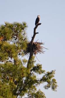
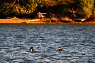
Eagles nest and lookout Loons in winter garb
The weather turned very cool (down to the low 40's or 30's (F) at night) with "patchy frost warnings." We had our diesel furnace on and greeted the sunlight greedily when it appeared at7:20AM to warm the cockpit. We watched the eagle (yes, s/he did arrive at the nest although the fledglings are gone), turkey vultures, loons and geese. Another boat anchored near us with their standard poodle on board. We think they were locals who were training the dog to use the bow as a head. The dog was a quick study... it was fun watching the training process. The boat left at 4PM, which is why we think it was a local boat on a training mission. Sun set a bit after 6PM.
Mill Creek, near the mouth of the Great Wicomico River on the western shore of northern Virginia. The wind was calm for the next leg of our trip, so we motored to Mill Creek. This is a very pleasant anchorage with large homes along the shoreline.
Mill Creek
Fishing Bay on the Piakatank River, western shore of Virginia. We had another day of calm with a murky sky, so we motored to the Piakatank River. In 2006 we went 10 miles up the river to Wilton Creek to wait out a SW gale. This year we are near the mouth of the river with light southerly winds.
Fishing Bay
Sarah Creek, York River, western shore of Virginia.
The trip to the York River was with a lazy NE wind, so we had the main up, but motored the entire 35 miles. We stayed at a marina in Sarah Creek so that we could do provisioning and trouble-shoot a malfunctioning head / holding tank. Eventually we solved the problem, but discovered the new joker valve we bought in Toronto was defective and we temporarily lost an essential small part in the Y-valve that allowed the holding tank to fill with sea water.
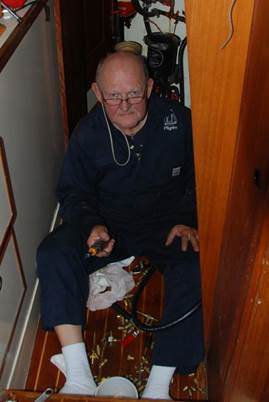
Brian working on
yet another series of problems caused by defective spare parts
We stayed an extra 2 days at the marina because of very strong southerly winds, reaching 30 knots.
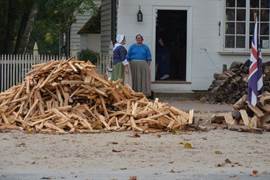
We decided to do some sight-seeing and we took a taxi to Yorktown, and then took a shuttle bus to Colonial Williamsburg. We were a bit disappointed. There was only one option for buying a ticket ($41/person) to get into the buildings and staged events. When we arrived it was already noon, and the last shuttle bus left at 3:30, so it was not worthwhile for us to spend $80 for 3 hours going into buildings. We did plenty of walking and felt the site had been well-reconstructed and maintained but was definitely as much a shopping experience as a historical education. It is quite clear we are now in the south. Canned Collard greens and smoked turkey wings (they are cooked together ... the wings to give flavour to the greens) are common on store shelves. The trees are southern, with our first sightings of live oaks. Churchyards feature graves of confederate soldiers.
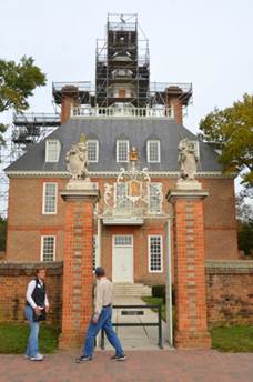
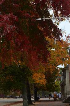
Colonial Williamsburg Governor’s Palace and
fall colours
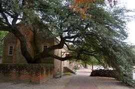
Live Oak
Remains of a live oak
We left the York River
on November 2 with no wind but the promise of moderate winds from the north,
which we thought would get us around Cape Hatteras without incident. For what REALLY happened, see your next
update, The Carolinas, Georgia and Florida.