Labrador, Tuesday July 12- Sunday, July 31, 2011
Both Labrador and Newfoundland share several extraordinary features that are best addressed all together: Sea Mammals, Ice and Fog.
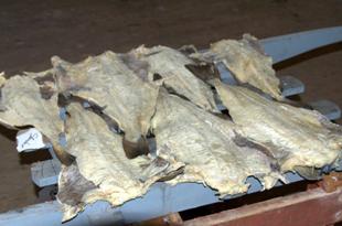
Sea Mammals / Whales. The sea off Canada’s NE coast is rich with sea mammals, and use to be very rich with fish before foreign bottom-scraping trawlers started decimating the fish supply in the 1950’s, and Canada’s fishing fleet followed suit. It was not until the 1990’ that serious attempts to control overfishing began by closing down the industry and allowing fish stocks to rebuild. Seals, dolphins and whales are still in relative abundance but except for seals nowhere near their former numbers.
Our main encounter with seals has been when they drift by our anchored boat just to check out the temporary camper in their territory. We also see them in channels, very curious about non-living things that float. We understand (but did not observe) that seals lived on the ice islands we will describe in the next section on Ice. Seals were a mainstay of the fishery in the 17th – early 20th centuries. In the mid-20th century there were many protests about the seal harvest, probably because “cute” baby seals were clubbed, not a pretty sight, and easy to tug on urban heartstrings that often do not understand the local conditions, culture and economy.
In 6 years of sailing in the oceans, we have never tired of watching dolphins swimming in our bow wave. Coming down the Labrador coast we encountered several pods of Atlantic White-Sided Dolphins. Our mere 6 knots of speed quickly boars them, and they move on to find another interest.
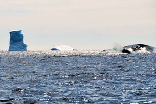
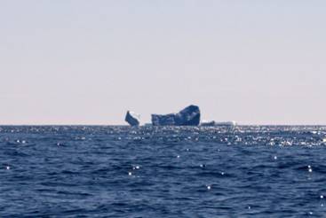
The whales have been a great delight, since we have not seen any since June 2006 when we encountered 3 Finbacks in Gaspé. Our first awareness of a whale being close by is usually seeing a small cloud of mist over the water, then a fin or tail out of the water. We saw a number of Minke and Humpbacks just south of Grady Harbour when we left Cartwright. One mom and calf Humpback breached, probably trying to distract us away from their territory. It is humbling and spectacular to share water with whales and dolphins, and we are fortunate to have had this experience.
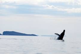
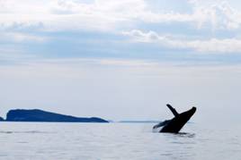
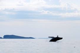
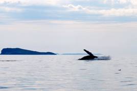
Humpback mom playing around or
chasing us away?
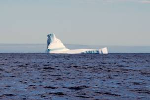
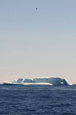
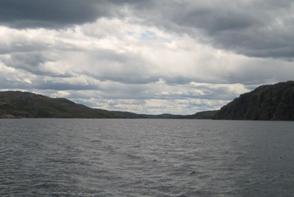
ICE. One of the reasons we wanted to take the North Atlantic route back to North America (besides its being a shorter route) was to see ice in its many forms. During our passage from Iceland to Canada we specifically avoided the ice that plugged Greenland’s coast, and we hove-to our last evening before landfall to avoid small bergy bits that we encountered as we neared the relatively shallower water along Labrador’s coast. Once we began our cruise down the south Labrador coast, we encountered ice. First, we found large bergs that had been grounded on shoals along coastal islands in Domino Run (53⁰ 30’N 55⁰ 47’W). We saw a beached berg on a shoal marked by a cardinal buoy! The berg was much easier to see than the buoy. There were plenty of bergy bits to avoid. A beautiful grounded berg on American Point, Island of Ponds, had a finely sculpted archway when we entered Sandy Bay on July 18. When we left the bay 3 hours later to find refuge from a fierce NW thunderstorm in Bateau Harbour, the berg had been dashed in half by the winds and rough shore rocks, with bergy bits floating out to sea.
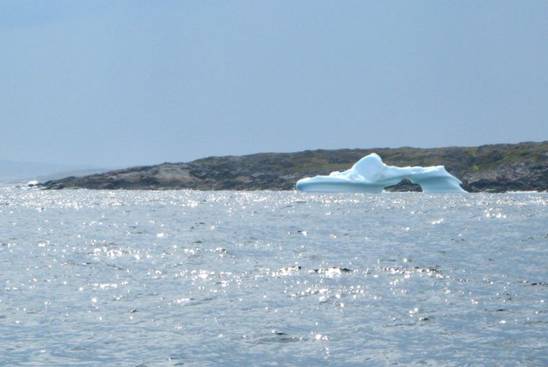
The iceberg “Enterprise”
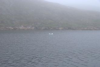
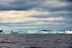
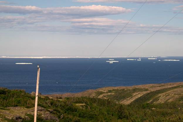
The ice reports from the Labrador Coast Guard were nebulous: something about ice islands in the “iceberg limit” spawning bergs. “Navigators are reminded to proceed with caution.” While in Cartwright we used the school’s CAP (internet) site to get information about this ice island. In late April the Coast Guard reported that a massive iceberg that calved off the Petermann Glacier in August 2010 had taken nearly nine months to make its way from the northern part of Greenland to the northern part of Labrador. It started out as a 251-square-kilometre ice island (4 times the size of Manhattan or the size of Bermuda) but has trimmed down somewhat, to roughly 64 square kilometers (the size of Manhattan). Although there were satellite images and helicopter fly-bys, ice reports were not helpful to mariners in the specific location, speed or direction the island was taking. After we left Bateau Harbour (53⁰24’N 55⁰46’W) on July 21 we began to see 15-20 floating icebergs at any given time 3+ miles off the coast. On the horizon we often saw a blur of white, ice and fog, but were unable from the deck of a boat to determine if we were looking at one entity or lots of bergs. July 25, on our approach to St. Lewis in Fox Harbour (52⁰22’N 55⁰41’W), we had convinced ourselves that what we saw was indeed an ice island. A small fishing boat called us on the radio; they were going out for a closer look!
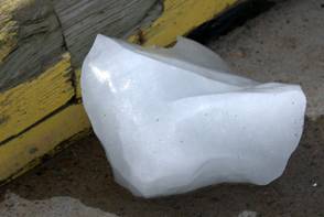
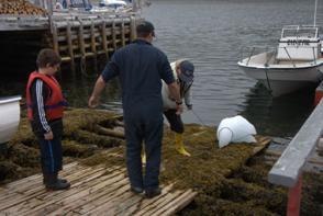
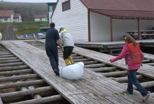
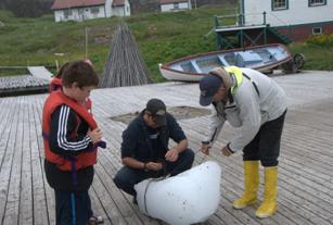
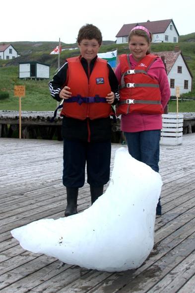
Roy and helpers heading out to fetch
some fresh (130,000 year old) ice and his gift to Pilgrim
We docked in St. Lewis, hiked up a hill (former location of one of the Distant Early Warning (DEW) stations) and from 200 meters above sea level could clearly identify the island, complete with ponds, rivers and waterfalls. Some said there were colonies of seals living on the island. The island was surrounded with bergs and bergy bits. Our strategy going south was to find an anchorage when we encountered offshore ice, wait for 2 days, and then move further south. A comfortable run for us is 20-25 miles in a day. The South Labrador current pushes ice along at about half a knot, or 12 miles in a day. Thus we tried to stay behind the ice, especially the ice island, as we traveled.
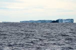
Icebergs we have met along the way
Small ice islands that can calf into
small icebergs
Gravity defying icebergs and grounded
icebergs
PII-a ice island
Fog. The third feature of the Labrador/Newfoundland coast is fog. Sea fog is formed when warm moist air moves over colder sea water and ice. Unlike radiation fog over land, sea fog often forms when winds are moderate or strong, and unlike land fog, it does not burn off and is not affected by sunshine as much as fresh westerly flowing air. Fog is a mariner’s nightmare, especially in ice-filled waters. Radar can detect the towering bergs, but not the bergy bits and growlers, which can do great damage to boats. While at anchor in Cartwright, we saw the fog banks forming along the coast, rise over the hills, and settle close to the “inland” community of Cartwright.
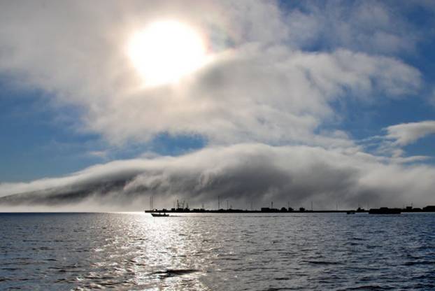
Cartwright in a developing fog bank
Weather in general. Being back in North American with continuous marine broadcasts the weather forecasts and notices to mariners is a dream. In Europe, if you can get a forecast at all, it may be in a language you cannot understand. The most frequent continuous marine broadcast schedule is in the UK and Ireland (every 3 hours), but a marine broadcast with weather information does not exist at all in Germany, Norway, Latvia, Holland or Denmark. It is good to have frequent weather forecasts, we just wish they were consistent and bore some resemblance to reality. The local land topology and resulting wind patterns can greatly modify the forecast even over a space of a few miles. The GRIB files also bear no relationship to the radio forecast or reality. The wind can be 20 knots from the E in the morning, and then be just as strong from the W in the afternoon or evening. Every few hours the forecast changes, and the extended forecast changes many times. Good news; bad news. The result is that we use our best instincts, stick our nose out, but are prepared to go right back into port if necessary.
Flags: We are proud to fly the Canadian ensign, and try to keep our flag as tatter-free as possible without changing it 3-4 times a season. We are also careful about the courtesy flags we fly. For example, when in Sweden on the island Gotland, we flew the Swedish flag, but also the Gotland flag under the Swedish flag. When on Bornholm Island, we flew the Danish flag, but also the Bornholm flag. When we learned there was a Labrador flag in addition to the Newfoundland/Labrador Provincial flag, we decided to fly the Labrador flag as a courtesy flag while in Labrador. We think it has struck home with many Labradorians that we fly not only their country flag, but also their land’s flag. Labrador joined Canadian Confederation with Newfoundland in 1949. The Labrador flag was first flown on March 31, 1974 to commemorate the 25th anniversary of becoming Canadians before the Newfoundland and Labrador provincial flag was introduced. The Labrador flag was created by a member of the House of Assembly for Labrador South, Mike Martin. He is reputed to have designed it as an affront of political mischief aimed at Joey Smallwood and Smallwood’s indifference to Labrador. Martin is a native of Cartwright, so it was particularly important that we fly the Labrador flag when we entered Canada at Cartwright.
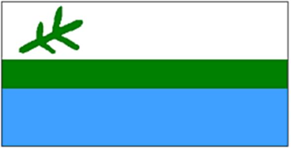
The top white bar represents the snows, the one element that more than any other colours the culture and dictates the life style in Labrador. The bottom blue bar represents the waters of rivers, lakes and oceans. The waters, like the snows of winter, have been the highways and nurtured the fish and wildlife that is both sustenance and the basis of economy. The centre green bar represents the land – the green and bountiful land that is the connecting element uniting 3 diverse cultures. The twig of the black spruce tree, in two year-growths, represents the past and the future. The shorter growth of the inner twig represents the hard times of the past, while the longer outer twigs speak of hopes for the future. The twig is typically in three branches and represents the three original founding races of modern Labrador – The Innu, the Inuit and the white settler. The 3 branches emerging from a common stalk represents the commonality of all humankind regardless of race.
Labrador Impressions: We are not scholars and we have not studied the history of Labrador, but talking with local residents and observing the deserted outposts we wonder if Labrador has benefited by joining Confederation and being a province with Newfoundland. Fishing was the mainstay of life in Labrador until the fish were gone. Labradorians did not encourage overfishing of its waters; the government of Canada allowed foreign trawlers to overfish and Canadian trawlers followed the foreigners’ lead without government reprisals. Before confederation with Canada Labrador was a British colony, almost forgotten by Britain. Survival depended on a community working together to build wharves and houses, take care of the sick, school the children, and maintain order. Shortly after joining confederation, the provincial and federal governments provided incentives for families to move from smaller outposts to larger centres, since they could provide services more efficiently in a few large communities rather than many small outposts. Now, after 60 years in Canada, governments are tightening belts, and Labradorians seem to be on the receiving end of the cuts. The national broadcaster, the Canadian Broadcasting Corporation (CBC) has no service except in the far south (and probably in Goose Bay and Labrador City, which we did not visit).
There is no permanent Coast Guard service north of Newfoundland; charts of the waters are sparse on detail the further north you travel. For an area traditionally dependent on the sea, cutting Coast Guard service is disgraceful. In addition, with many private yachts interested in making the Northwest Passage, and with cargo ships considering “short cuts” from Asia to North America via the Arctic, more service would seem prudent. This year has been particularly dangerous because of the Ice island(s). One would imagine that with satellite images, aircraft surveillance, and requests for ships to provide ice observations every 6 hours the Coast Guard could provide accurate tracking of the ice islands, but their ice reports are almost a joke and of little help. As we went down the Labrador coast, there were times we could count 20+ bergs from one vantage point. The ice report said there were less than 10 confirmed ice bergs.
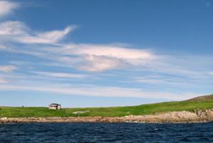
Our last stop in Labrador was Battle Harbour. The British set up a trading centre there in the 18th century. In the 19th century when the French were allowed to fish off the eastern banks of Newfoundland, the Newfoundland fishermen migrated north into Labrador. Some set up summer outposts in Labrador while others lived aboard schooners that fished all summer, returning to Newfoundland for the winter. It sounded to us like the Newfoundlanders were invading Labrador and taking advantage of Labrador fish stocks rather than compete with the French in their own waters.
Our first harbour in Newfoundland was Griquet. It was one of Newfoundland’s outposts, but the fish processing has been moved and there is little fishing activity in this small village. However, we were amazed that there was a bridge to the mainland (1984) and the road was actually paved; the first paved road we have seen since Iceland! Seems that the infrastructure money is being spent in Newfoundland first. Perhaps we are unaware of the reasons for gravel roads in Labrador (frost heaving, lack of traffic, etc.) but it is an observation.
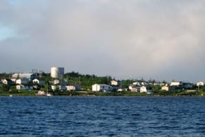
Cartwright Harbour
After a cold, windy and mainly sunless May, June, and 2 weeks in July, Cartwright showed us the sun on July 14. What a treat; BUT…what a lot of bugs, from mosquitoes to black flies, hornets to horse flies.
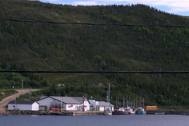
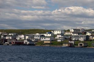
Cartwright is a very small village (population around 600), with few services for yachts. There are two wharves, but only one available for visiting boats. There is only one spot with a ladder on that wharf, and at low tide (5 foot range) it is tricky to reach the bottom rung of the ladder, especially if the wind is blowing the boat off the quay. In short, dock space is very limited for visitors. We were rafted off a steel-hull schooner, Issuma that is hoping to make the NW passage east to west this summer.
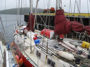
Schooner Issuma
and Pilgrim sharing a ladder and wharf at the Cartwright Marine Service Centre
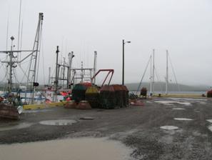
The Marine Service Centre that used to manage the quay is no longer in business. There are electrical outlets, but no power service or water on the wharf. There is a “boil-water advisory” in Cartwright, which is quite common in Labrador, so even if we could have filled our tanks, we would not have done so.
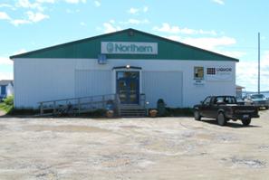
There is no charge but then you get what you pay for. There is a grocery store, a real hardware store, a library in the school and a pub that have Internet. There is no cellular signal, but a pay phone in the grocery store accepts calling cards. Cartwright used to be a thriving town with small cargo ships, ferries and fishing boats and a thriving fish plant. Now that the road has been opened to Quebec, the need for cargo ships and ferries has greatly diminished, and with the severe limitations on the fisheries, few boats go out commercially and the plant is not in full operation. Small open boats take tourists up the salmon rivers, but that seems to be the biggest fishing activity in Cartwright. The people are very friendly, especially if you act like “just folks” and wave when they pass in their cars or on their bikes. In the evening we heard a Loon, our first since 2005 in the North Channel, Lake Huron.
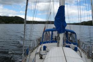
Curlew Harbour / Southeast Cove. We had some surprises once back at anchor. Our first harbour, Southeast Cove, Isthmus Bay (53⁰45’N 56⁰37’W) with “easy access entrance” unexpectedly shoaled to 10 feet where the chart indicated we should be in 50 feet. We bailed and went to Curlew Harbour where we did not find good holding in mud as promised in the cruising guide (but there was little wind, so no worry).
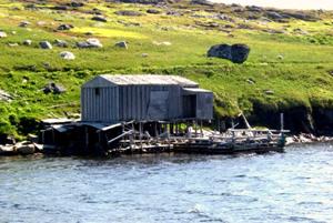
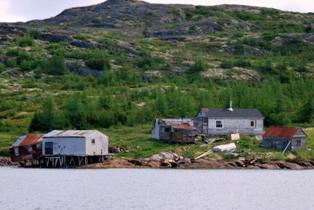
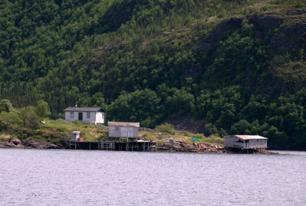
Sandy Bay / Bateau Harbour. The report for the anchorage in Sandy Bay (53⁰24’N 55⁰48’W) did not live up to is short, sketchy description. When a NW thunder squall hit, we dragged our 45 pound CQR, and could not get a good set with it or our 22 pound Danforth. We retreated to nearby Bateau Harbour (53⁰24’N 55⁰46’W) with better protection against NW winds. Another yacht, aluminum hull, was already anchored. Through the night Brian kept anchor watch while we experienced 25-33 knot gusts of wind. When the wind backed south the next day a local resident in an open boat came by and suggested we move into the Inner Harbour where there was a bit more protection. We moved the boat and anchored for 2 nights waiting for the strong south winds to give us a break. There were about four men who lived in the houses at Bateau Harbour; some of the houses looked new with covered foundations, while others lacked paint and looked like a winter storm would blow them over. There were also a number of houses that had collapsed. The wharf and fish processing plant were still standing, but the wharf did not look secure. Some of the residents kept their open outboards around the back side of the wharf where there was the best protection, and probably the least deterioration.
From our boat in Bateau we watched the waves breaking over the outlying islands at the mouth of the harbour. We could hear the surf pounding on the other side of the peninsula between us and the sea. We noticed that if the white foam from the waves did not disperse within 15-20 seconds, it was a bergy bit being forced inland.
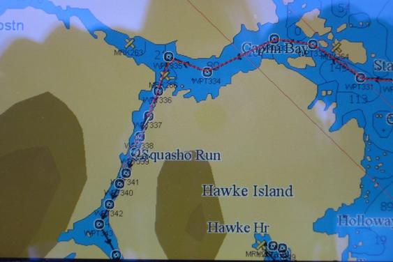
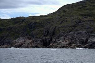
Squasho Run is a natural channel that runs for about 8 miles with steep cliffs or hills on either side. This backdrop to the bergs was also incredible. Low rolling hills with brilliant orange rock at the shoreline changing to grey up the hill, and covered with pine trees and soft green growth. The sun was out most of the day with ever-changing clouds in the sky. Some may say the scenery was not as spectacular as in the Faroes or in Norway, with the high waterfalls and steep cliffs, but as far as the eye could see, there was beauty, ever changing.
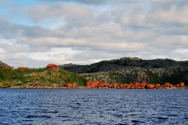
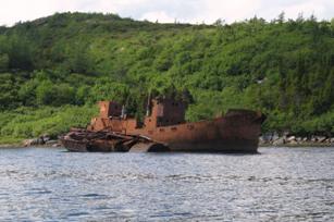
Hawke Harbour We carefully selected Hawke Harbour as our anchorage, expecting strong (25 knot) NW winds. It is a very secure spot, and early this century was the site of a whale processing plant. The plant burned in the 1950’s, and most of the buildings are in partial ruins, but the site is clearly visible. In the bay in which we were anchored were the hulks of two steel-hulled whaling boats left to rust. There are a number of houses and docks, but none appear to be occupied, and there is no real community here anymore. At 6PM another sailboat entered the harbour and has anchored near the old whale processing plant in another bay. The resident seal paid a visit during dinner, and the HUGE resident mosquitoes and black flies were swarming the cockpit enclosure. We spent the evening in the cabin with the screen securely in place for the first time in about 3 years.
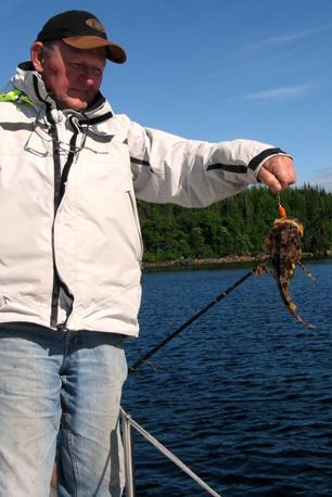
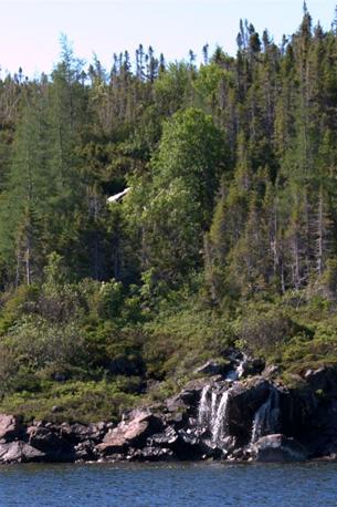
Occasional Harbour Occasional Harbour (what an odd name) is in a fjord about 3 miles long. There is a small settlement with at least one house still occupied. Folks were in an open boat tending a net at the end of the fjord where we anchored. The cove (Arch Cove) is relatively wide, but with a good shelf off the shoreline. At the entrance to the cove there is a small waterfall … nothing spectacular as in Norway or the Faroes, but a constant steady stream of water and babbling sound. The shoreline is rock, but also has evergreen forests. It is much like Lake Superior, but without beaver and the beaver-swamps. Brian was very successful catching small Angler fish (Monkfish), but these were 6-10 inches long and not worthy of keeping, since the only edible part is the tail. Normally adult monkfish are 3-4 feet long. One of our cookbooks has a picture of Julia Child with this horrible enormous fish from which she is pointing out the edible tail.
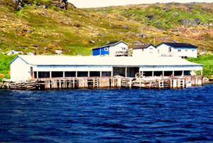
St Lewis / Fox Harbour The cruising guide told us Fox Harbour provided the flexibility of either tying to the wharf at the fish processing plant or go to anchor. The promise of the wharf (according to our cruising guide) was laundry facilities, showers, power and water. Unfortunately, the fish processing plant (handles shellfish) was closed for the season and water and power (and of course washers/dryers/showers) were inoperative.
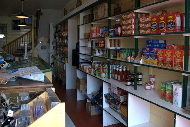
After we secured to the quay and chatted with the fish plant manager (who said, “stay as long as you like; nothing is coming in now”) we walked around the bay into the town, population around 200. There were three stores selling everything from gifts to groceries, hardware to lottery tickets. The only “fresh produce” available was shriveled green onions, a rotten green pepper and a few yams. The truck with fresh produce arrived the next evening.
The weather was sunny and warm. We opened our portholes for the first time in 2 years. Luckily our portholes have screens. The bugs were vicious, and the hydrocortisone cream came out of deep storage.
A number of folks drove by our boat on the quay and asked if we had seen the ice island. We said, “yes, we were just out along the coast.” They said, “you can get a good view from the old US Pinetree Line Station on top of the hill. (Back in the 1950’s and 60’s when everyone was paranoid about Soviet attacks on North America, Canada let the US install a complex of Radar stations to detect (early … while they were still over Canada, not the US) Soviet missiles intended for attack on the US. The site (a mere 2 km walk up a washed-out road on a steep hill) has disintegrated over the years, but provided a magnificent view 600 meters above the sea of the South Labrador coastline. We were not prepared for what we saw. The Ice Island was about 55 square km (21 square miles), about the size of Manhattan, with 80-100 ice bergs, bergy bits and growlers guarding the island. From sea level we could only see a small part of the extent of the ice flow. The ice island moves with the current at .5 knots, the bits and pieces move with the island but may also scatter due to winds resulting in a much larger ice infused area. One of the nurses at the local clinic saw us laboring up the hill and offered us a ride to the top (much appreciated). We, in turn, invited her aboard Pilgrim for a tour and gave her some previously-read books. Later she invited us to her house for dinner with some of the local residents and to use her shower (YES). What hospitality. One of the dinner guests was the kind soul who brought us a sample of glacial ice from the ice island. The ice graced our evening drinks and the remainder was melted down to add to our dwindling fresh water supply.
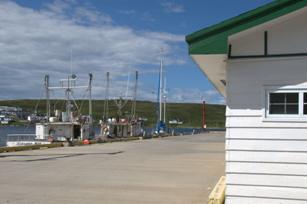
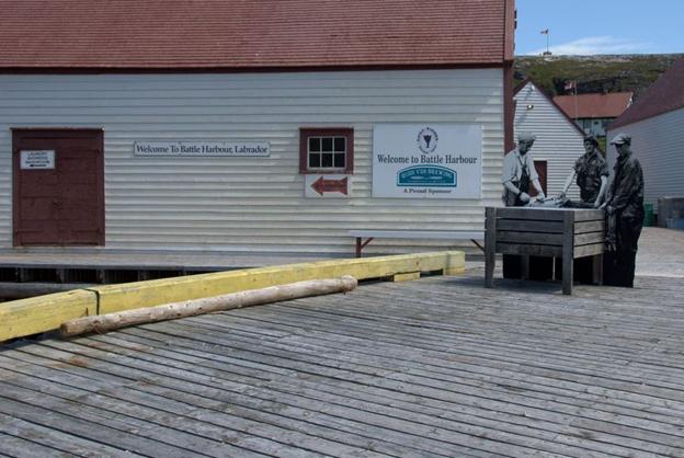
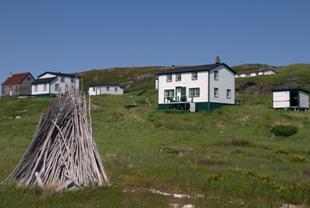
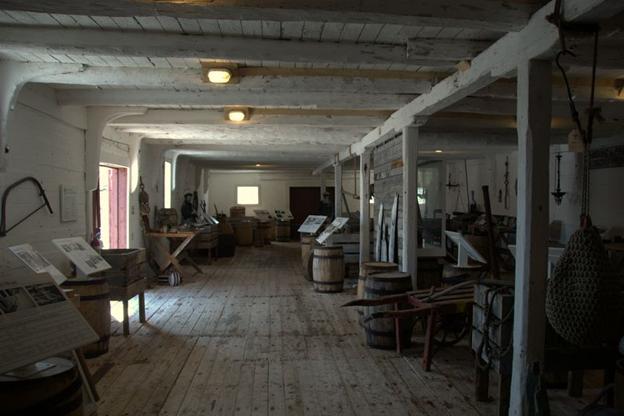
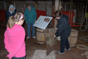
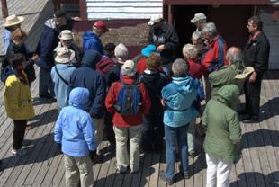
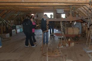
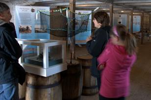
Battle Harbour Battle Harbour is formed by a couple of islands SE of the Labrador coast and just north of Belle Isle (unpopulated large island halfway between Newfoundland Labrador). In the 18th to early 20th centuries it was an important merchant site, importing salt (for the cod fishery) and dry good for the inhabitants, and exporting salt cod and salmon. It was the unofficial capital of Labrador. When the salt cod fishery went into decline early in the 20th century, the settlement started to shrink from its top population of 350. When the cod fishery really went into serious decline in the 1950’s most of the people were moved to larger towns. In 1990 a charitable trust was established to preserve the buildings and artifacts, mainly from the 19th century. There are a few summer residents, rooms and cottages for rental, and a ferry that runs to the mainland twice daily. The trust runs tours of the restored buildings, and meals are available in the General Store if pre-booked.
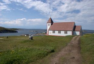
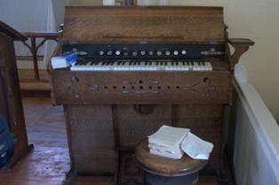
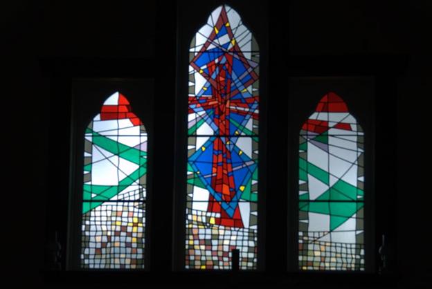
The Anglican church built in 1857 is in relatively good condition with kerosene lamps and a pump organ. A stunning modern stained glass window graces the chancel.
During our second day, dense fog settled in with 20 knots of wind from the south. We used the layover day to spend time back in the restored buildings looking at the exhibitions more closely than we could on the tour. We have learned much about Labrador/ Newfoundland history. For example, in the 19th century, when France was fishing the banks off Newfoundland’s east coast, Newfoundlanders simply invaded southern Labrador for their fish rather than compete with the French. There was a Marconi station at Battle Harbour which Robert Perry used to announce his 1909 North Pole adventures to the world.
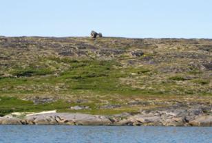
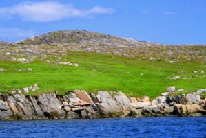
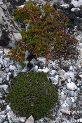
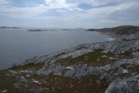
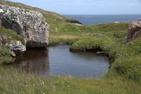
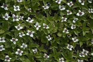
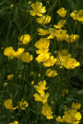
The small island is also fascinating for its geological structures and over 200 vascular plant types. The solid granite stone has spongy moss / bog-like coverings, tiny ponds, and many off-shore shoals and small bays.
![]()
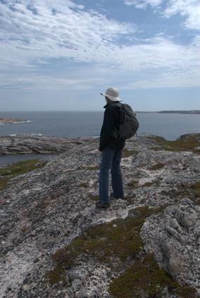
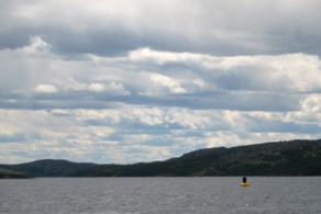
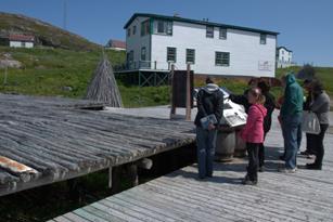
As an added tourist bonus some small bergy bits have entered the harbour from a growler stuck at the south tickle … not enough to do damage … just enough to get the cameras shooting.