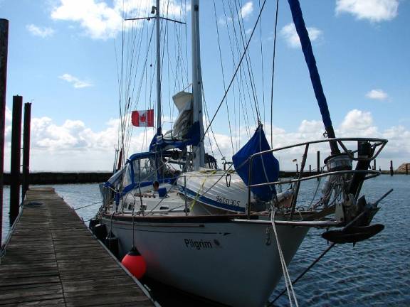
Germany and the Baltic Sea (May 2008)
Germany: The Friesian Islands
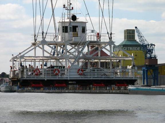
These islands are sandbars above the water level at high tide surrounded by lurking and shifting sandbars under the water. The 10-foot tidal range means the beaches are very wide at low tide and the water is warm because it is so shallow. As a result the islands are holiday destinations and many high-speed ferries connect them to the mainland. Shallow, meandering, buoyed channels lead to sheltered harbours on the mainland sides of the islands. The trip from the navigable waters of the German Bight in the North Sea into the harbour is about 5 miles, which takes us approximately one hour. Getting into and out of harbours takes about 2 hours out of our daylight sailing time. Shallow-draft boats can use passages between the mainland and the islands, saving some time and providing protection from the weather, but Pilgrim is not a shallow draft boat. Therefore, we decided to make the minimum number of stops in the Friesian Islands.
Our first stop after Lauwersoog in the Neatherlands was Borkum, the western-most of the German Friesian Islands. The channel into the harbour is in the Ems River, generally the boundary between the Netherlands and Germany.
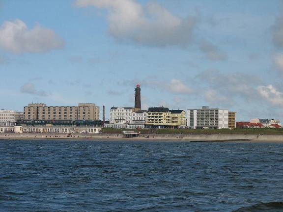
The public beach on Borkum few people due to cold and wet weather
There is a 2-knot tidal current, and we arrived at the mouth at slack water, low tide. We took the advice from our cruising guide (Reed’s) and went into the small pleasure craft harbour rather than the main commercial harbour. As we nosed our way in the first slip inside the harbour, we ran aground. We were able to slither through the mucky bottom and tie up.
Pilgrim spent low tide buried 6 inches into the mud … at high tide she managed to pop out
We checked in with the harbourmaster and checked the depths at a long pontoon where most of the larger boats had tied. As the tide refloated us, we moved to deeper water, but were still nestled in the muck at low water (still it was better to be buried one foot in muck than four). The floating pontoon was a steel plate frame over drums, and the steel was rusting badly. We wondered if improvements had been made to the docks since the 1940’s.
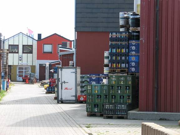
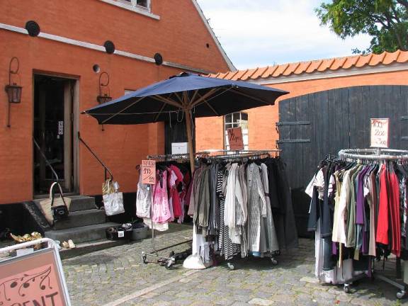
The harbour is far from town and shops / bank machines, etc. .The harbourmaster in the commercial harbour helped us with bus schedules, tickets and directions to the market and bank. We discovered that many Germans do not speak English unlike the Dutch who usually speak English and German in addition to Dutch. Jane’s very rusty 40-year-old German from university came back readily enough, augmented by a translation dictionary. We did 4 loads of laundry (3-weeks-worth) using two washers that took 2 hours per cycle, an evening’s entertainment.
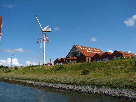
The marina consists of an expensive restaurant and 3 wind generators …showers cost
Germany: The German Bight, North Sea
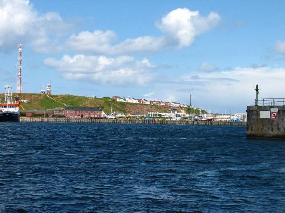
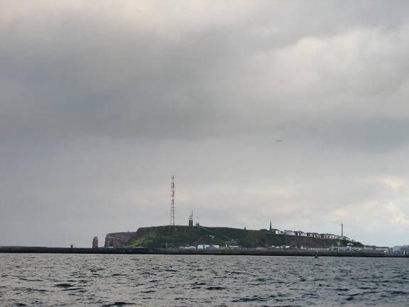
We left Borkum at mid-tide, taking advantage of the ebb current to take us out into the North Sea. The moderate wind from the NNW was right on the nose, so we had wind against current, building up very steep, uncomfortable waves that took away most of the current advantage. One large wave and following trough caused Pilgrim to drop about 20 feet jarring the boat with the impact. Later we discovered how much damage was actually done to the engine. Once we got out of the channel, we had an excellent sail due east, just south of the very busy shipping lanes into Bremerhaven, Cuxhaven , Hamburg and the Kiel Canal. Our destination was Helgoland, a sandstone island about 35 miles north of the German coast and west of Denmark. People go to Helgoland for one reason: duty-free goods. The tourist brochures do not mention duty-free but extole the wildlife, beaches, and vistas. To take advantage of currents we left Borkum mid-afternoon and planned to arrive at Helgoland, 80-miles away, early in the morning. At midnight we arrived at our turning point where it was “safe” to cross the shipping lanes outside the Traffic Separation Scheme (TSS). We were shadowed by a patrol boat to ensure we did not cross the TSS improperly! From 5 miles off we could see what appeared to be a city in the middle of the shipping lanes, and our AIS system (gives positions of commercial boats) showed at least 30 boats in the vicinity. 90% of them were anchored, but in the dark, even with the aid of AIS and radar it was difficult to identify which boats were moving and which were at anchor. It took us an hour to make the turn north. For a time we stayed just outside the shipping channel to the Jade / Wesser River to avoid oncoming boats. Then we slowed down to let a boat pass, and then sped up to keep in its “shadow” across the shipping channel. Once we cleared the shipping lanes, we could set sail again for the 10 miles north to Helgoland.
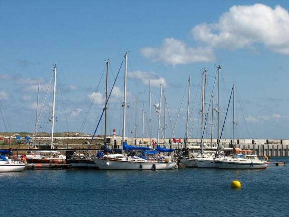
We arrived at 3:30 AM and anchored inside the break wall for an early breakfast and a bit of rest before checking in with the harbourmaster.
The
anchorage area was clear …it seems no one anchors here … Boats would rather
raft 4 deep
After the island woke up, we filled our fuel tank with duty-free diesel (about $.50 less per liter than on the mainland), rafted next to a Polish yacht at the marina, then explored the town (duty-free shops).
Stocks of duty free goods waiting to be snapped up by tourists arriving by ferry
\
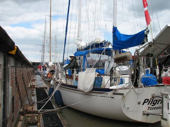
Rafted against a Polish boat who didn’t have any idea when they wanted to leave except it would be soon
We stocked up with our favorite libations and some vacuum-packed frozen lamb from South America, then moved back to the anchorage for the night, since we wanted to leave at 6:00AM, and did not want to be hampered by other boats rafting outside us.
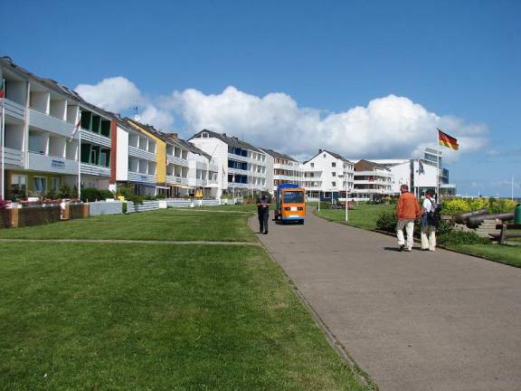
Very well developed vacation rental properties and support community
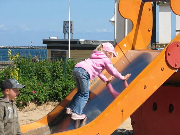
Ample playgrounds and equipment are provided for the kids
Our final view of Helgoland …a shopper’s haven
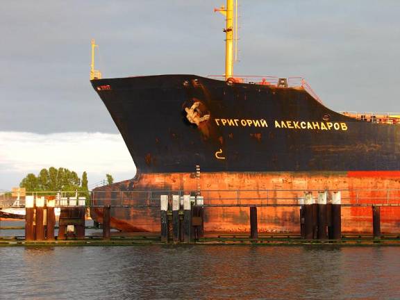
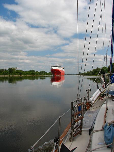
There was no wind for the trip from Helgoland up the Elbe River to the Kiel Canal, so it was a motor trip. The 3-knot current boosted our speed to 9 knots at times, and with no wind, waves were not a problem. The mouth of the Elbe is a wide delta of islands and shallows with maintained channels for commercial craft. It was imperative that we stay on the sometimes-hairy edge between the shipping channel on the right and the marshes on the left. The commercial traffic was heavy and there was a great variety of boats: container ships, bulk carriers, tankers, tugs & barges, pilot boats, ferries, cruise ships, excursion boats, fishing boats, dredgers and a few we could not identify. Some of the boats ignored the channel, leaving us to guess how to avoid them.

A fishing boat with the ever-present hopeful gulls
In all of our travels … the St. Mary’s River in Lakes Huron and Superior, the Welland Canal joining lakes Erie and Ontario, the St. Lawrence Seaway, the Chesapeake Bay and Delaware River, The Intra Coastal Waterway (ICW), and Land’s End and the English Channel in the UK … we have encountered large numbers of all types of commercial craft in confined conditions. The North Sea, off Holland and in the German Bight, has been the most challenging for us.
Frankly, we did not enjoy sailing on the North Sea because of the water, the depths and the shipping traffic. The water was opaque brown with a tinge of green. Large patches of foam floated on the water, like scum, catching flotsam and jetsam, and making the water look much rougher with waves than it really was. The Elbe River was like the Muddy Mississippi River. What a surprise to see a small pod of dolphins swimming down the river against the current.
One of the things we appreciated in maritime Germany was the colour of the red lateral buoys. They have a brilliant red-orange appearance and are very easy to see. We wish every country would adopt the more visible red-orange colour.
Germany: The Kiel Canal
We got to the Kiel Canal locks at 2:00, dodging freighters queuing up to get into the commercial locks. We had read that the small, southern lock was for pleasure craft and the larger northern locks were for commercial traffic. We joined 6 boats milling about (there is no waiting pontoon to which to tie), waiting for the call to enter the lock. A freighter was entering the smaller lock on the south as we arrived, much to our surprise. Once it was secure, we were ordered to join it in the lock! We slowly proceeded following the other boats. There was a very low floating wooden pontoon in the lock to which we tied, leaving about 20 feet between us and the freighter. There was an imperceptible difference in the water levels at the beginning and ending of our stay in the lock. All of us little boats got to leave first, before the freighter fired up her engines.
In the locks beside a freighter and with 6 other boats
Out of the lock, our next challenge was to get to the Brunsbűttel marina since we could not get to another stopping point before sundown. It is located behind the big lock to the north, and we had to rev our engines hard to get us across the channel of oncoming freighters for the big lock. It felt good to get secure to the dock in the marina and take a deep breath.
A pleasant stopover … all signs in English which no one spoke
Since the marina at Brunsbűttel is RIGHT next to the big lock, we will have freighters going within 100 yards of us all night. We were fascinated watching 2 large container boats and 2 smaller tankers come out of the big lock one after another. They were all handled together.
Spending the night beside a 24-hour commercial lock leaves one sleep deprived
The next day we traveled about 2/3 of the way through the Kiel Canal to the medieval town of Rendsburg. The voyage was an uneventful motor trip. There were about 20 cargo vessels that were southbound in the canal, but none passed us northbound. Birch and Horse Chestnut trees abound onshore, with many ducks, swans, coots and seagulls along the way. Car ferries crossed the canal in about 8 places. There are a couple of under-canal tunnels, and one suspension bridge that carries cars across the canal in a gondola about 20 feet above the water … like a cable ferry in reverse.
The gondola making its way across the canal while Oh, Canada plays in the background
When we passed the suspension bridge / gondola, we heard “Oh, Canada” being played. Evidently it is the custom for the national anthem of the country of foreign boats to be played when the bridge is passed. It reminded us of our trip down the St. Lawrence River 2 years ago when a cabin on the south side of the river blasted out the national anthem as we passed.
In calm conditions the canal can be spectacular
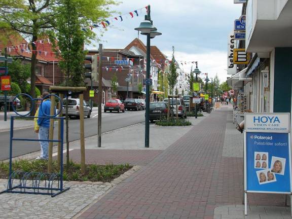
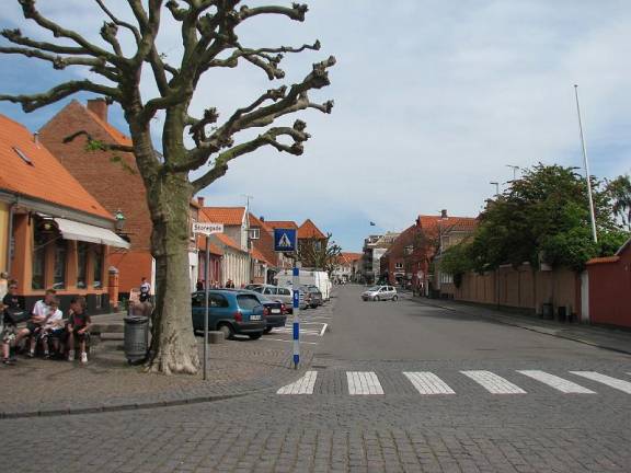
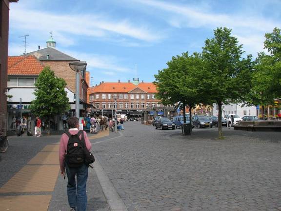
We spent a couple of nights at the Rendsburg Yacht Club so we could explore the town and get a couple of weeks of food provisions. The streets in the city are cobbled, and the buildings ancient if you look up to the second story and higher. The main floor windows are modern shops with standard North American / Western brands of clothing, watches, jewelry, shoes, etc. The town was much larger and more modern than we had expected, but charming with many flowering shrubs and trees.
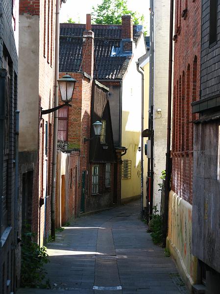
Narrow street in a medieval town
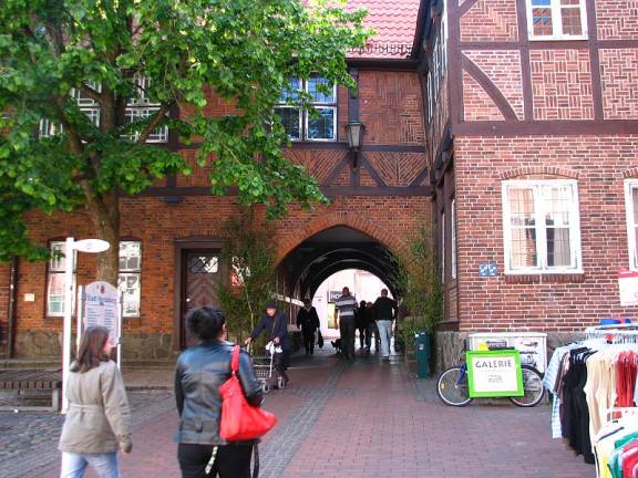
Town Hall Toll passageway … free to current visitors
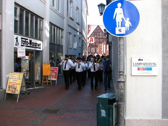
A
marching band followed by men in morning coats and top hats …objective not
understood
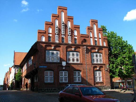
Das Alte Rathaus (town hall) was built in 1566 and has a functioning Glockenspiel.
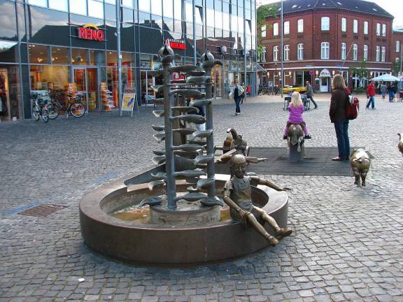
There were bronze statues all around the city, including in a play area for children.
Before leaving Rendsburg we looked at our charts and estimated the distance we had to go to get to St. Petersburg in just 4 weeks. We were not a quarter of the way there, and had spent half our time. We decided to skip the eastern part of Germany and Poland and leave that adventure to a motor trip in the future. When we left the Kiel Canal we headed directly across the southern Baltic to Lithuania / Latvia.
Our calm exit from the Kiel into unknown Baltic Seas
The Baltic Sea
On Friday afternoon the forecast was for winds from the NE (not good) but less than 20 knots (OK to marginal). When the wind stayed under 15 knots, we had good sails, but our windward progress was slower than we anticipated. The waves had built to about 12 feet (4 meters) and where steep Great Lakes type waves. Once we took leeway into consideration (mainly because of the waves) and our poor performance as a windward-sailing boat, we were tacking through 140 degrees, which was pitiful.

Two 12 metre America’s Cup boats had no problem with the wind or waves
On Sunday morning at 10:00 we were 30 miles from Bornholm Island, Denmark, but it took us all day to get there since the 30 miles were directly into the wind. We needed to rest after being underway for 3 days without stopping. We also needed to make a few repairs, and figure out a new strategy for getting northeast. Several times we hit a particularly large series of waves. Our bow would plunge down the first wave, then get buried coming up the second wave, with streams of water coming back the deck to the cockpit. These waves put a damper on our speed.
The cargo ships are everywhere. Although there are a few Traffic Separation Schemes in the Baltic, there are routes commercial ships follow, but they are not marked on charts. Therefore, when we do route planning, we often select waypoints that are in shipping lanes. As a result, we have spent time slowing down, speeding up, and changing course to avoid the ships, ferries and cruise liners.
There are many areas on the charts that indicate “Explosives.” Ammunition was dumped after the 2nd World War. Some of the areas were so extensive it was not possible to avoid them, especially since we were battling wind on our nose and large waves. Add to that the wrecks and firing ranges and you have a sad commentary on human history.
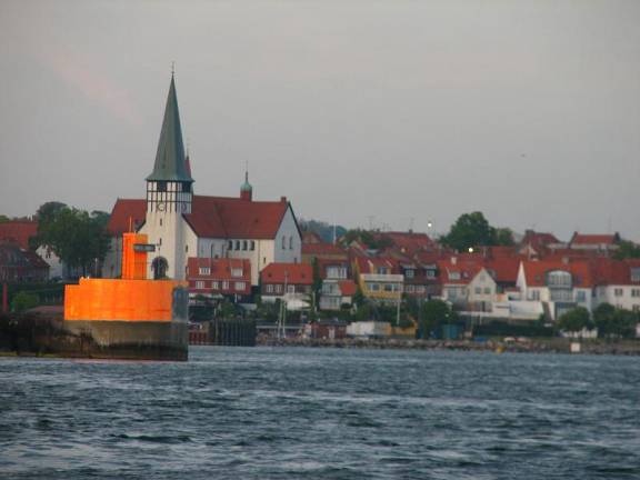
Spectacular entry into BORNHOLM … a safe refuge at last
We spend two days in Rønne on Bornholm Island.
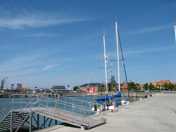
There were no facilities for boats our size so we ended up in the commercial harbour
The island has the highest number of days of sunshine in Denmark; our first day it rained most of the day while gale force winds buffeted us. We were glad we had decided to stop. The island has attracted many artists: painters, sculptors and crafts-folk in ceramics, glass and fabric.
A charming tourist town waiting for the first arrivals of 2008
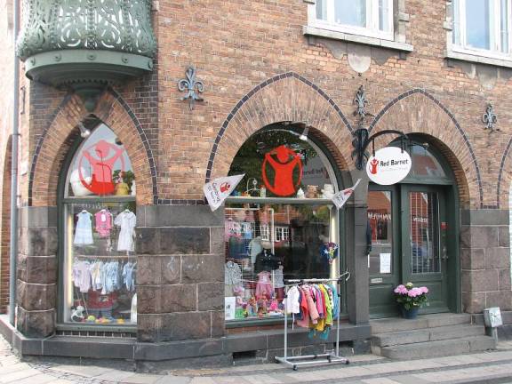
Save the Children used children’s clothing outlet
The major industry is tourism; the town has quaint and colourful buildings which we found marred by modern shops selling end-of-lines, souvenirs and cosmetics.
Bargains at any price as long as you don’t mind shoddy
goods
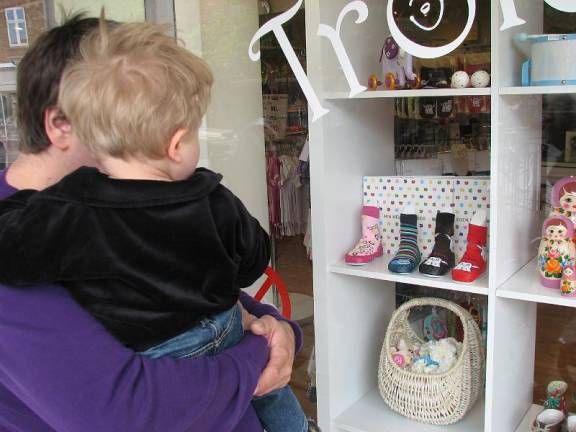
Dad training young son in joys of window-shopping …the wonders of commercialism
We bought smoked eel and mackerel and pickled herring at the fish market, and of course some Danish blue Cheese.
Great tourist town but expensive … $8 for a beer was a bit hard to take
We left Bornholm for the 220-mile trip to Latvia. We decided not to go to Lithuania since it is very close to Russian sea space in the Baltic (Russia has one port, Kaliningrad, stuffed in between Poland and Lithuania) and if we mistakenly drifted into Russian territory, our single-entry visa for Russia would have been used. Also, the wind was still raging in a gale in the southern and western Baltic; so it was best to sail north of Bornholm, skirt the shipping lanes, and land further north in Latvia.
Wednesday the wind was absolutely consistent from the NE ranging from 12 to 18 knots. We motor-sailed to clear the north tip of the island, then hoisted everything ... mizzen, main, staysail and Genoa. We were tacking since our target port was almost dead into the wind, but we sailed much better than on Sunday. The double headsail creates a funneling effect and made the boat point well. The waves were still pretty big at times 8-10 feet, but we were handling them at a better angle. We were able to sail with good speed and reasonable headway for over 24 hours. Then the wind died. We were still hearing gale warnings in the western Baltic, the Kattegat and Skagerrak, and the German Bight (North Sea), and were so glad we decided to push on eastward when we left the Kiel Canal.
On
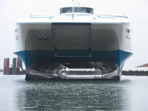
Bornholm we discovered that Pilgrim couldn’t fit under a catamaran ferry … they
have right of way regardless (This one
was turning to dock for the night close to us)