The Isles of Scilly lie 30 miles southwest of Land’s End and are part of the Duchy of Cornwall. Of the nearly 50 islands and rock outcroppings, there are only 6 inhabited islands. We took the ferry service to visit four of them (St. Mary’s, Tresco, St. Agnes and the Gugh (pronounced Goo). The islands are granite with a thin crust of peaty soil and were formed in response to a collision between continental plates between 200 and 300 thousand years ago; the Laurasian Mountains were thus formed and the peaks eroded away until the base granite was exposed. The landscape is characterized by granite carns on almost every headland. Some of these carns take the shape of animals (Camel, Nag’s Head, etc.). During the end of the last Ice Age when glaciers came as far south as mid-Britain, the water level was much lower and the islands were one large island. Legends tell of an idyllic “Atlantis” midway between the Isles of Scilly and Land’s End; today this is the Seven Stones reef, which has claimed many ships over the years. Some even speculate that the Scillys were part of the mainland at one point.
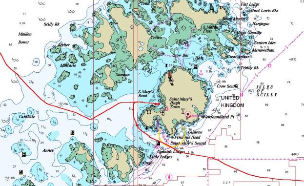
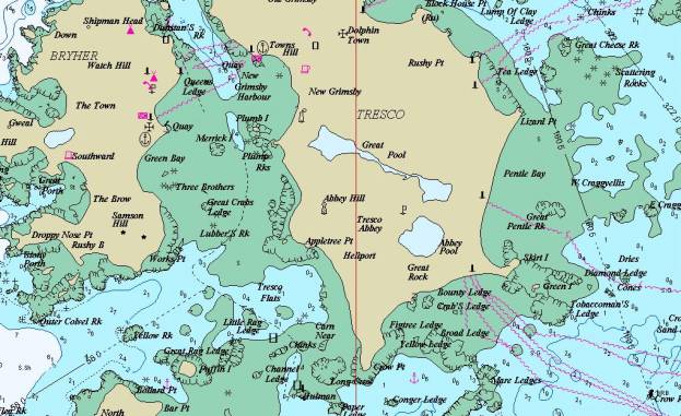
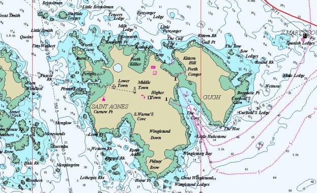
Some of the Islands of Scilly … our route from Ireland and on to England is in red
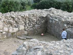
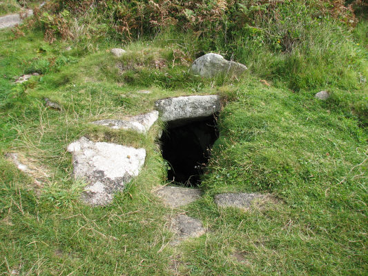
There is some evidence that Mesolithic people (8000BC-4000BC) and Neolithic people (4000BC – 2500BC) inhabited the Scilly Isles. In the Bronze Age (2500BC – 700BC) inhabitants created entrance graves on hilltops on almost every island and many of these remain today (70 of them are documented).
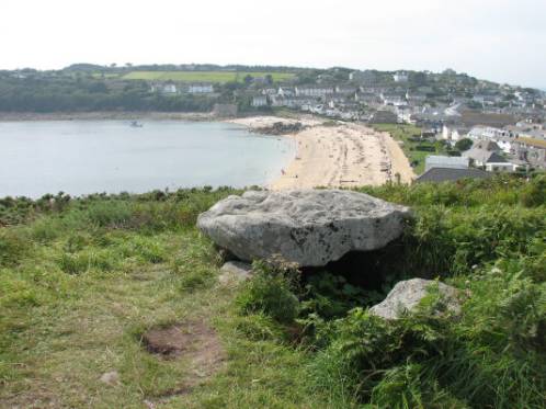
The rock slab forms the top of the entrance grave overlooking a crowded beach
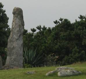
We also saw standing stones from the Bronze Age. From more recent history we saw the remains of a Benedictine abbey (1120), which is part of the Abbey Gardens on Tresco Island.
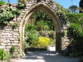
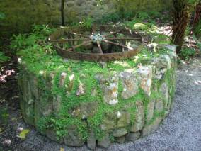
Benedictine abbey (1120) ruins and the well that supplied water to the
monks
As trade became abundant in the 16th century, fortifications were built, and often reinforced through the ages, and a number of examples remain on the islands. The most spectacular is the Star Castle on St. Mary’s that has been transformed into a hotel with restaurant, playing fields, camp site, and sportsman’s (shooting) club. Cromwell’s Castle and King Charles’ Castle are on Tresco Island.
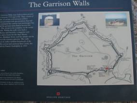

The Garrison including the Star Castle The only entrance in and out of the entire complex
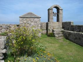
View from the parapets The Garrison is in very good repair
The increase in shipping and naval exploits around the islands brought shipwrecks, with treacherous waters on the west and north of the islands. In 1707 the British Navy lost 4 ships and 2000 lives one in just one night. British Parliament offered a prize for the person who could help ships determine their longitude with certainty (latitude could be determined by sun, moon and star sightings). Dava Sobel wrote Longitude in 1995, the fascinating story of the discovery of measuring longitude.
The Isles of Scilly (IOS) to not offer great protection for a boat our size at anchor, so we opted to take a visitor’s mooring, especially since we were in 20 knots of north wind when we arrived after an overnight (25 hour) sail from Baltimore in Ireland, and the harbour on St. Mary’s Island is open to the northwest. The mooring cost us ₤20. ($40.) per night with the 4th night free, and for that there were no services except a very good mooring, which we appreciated having as the wind continued to blow hard for the first 3 days.
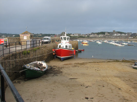
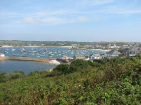
St. Mary’s harbour almost at low tide
St. Mary’s: We spent half a day walking the southern half of St. Mary’s Island. The view from the Star Castle on Garrison Hill gave us a good appreciation of our track into the harbour and the location of the other major islands.

Our entry, mooring and exit from the harbour are in red
The beach in the cove at Porth Cressa on the south shore was full of children and adults. About 20 sailboats were anchored off the beach, one of the secure anchorages in north winds. We were amazed at the amount of sea glass (and jagged broken glass) there was on the beach; evidently no one collects sea glass on the IOS.
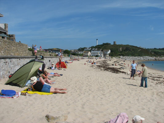
All beaches were crowded and full of very active children and adults in strange beachwear
We walked along the shoreline path with many benches along the way (Britain certainly caters to walkers). We enjoyed getting hopelessly lost trying to find a Bronze Age entrance tomb; so many people tried to help us find our way but always gave us the wrong directions.
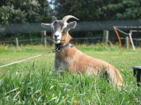
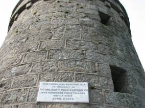
One of the locals that gave us the most accurate directions to this watchtower
After finding the tomb and a 19th century watchtower, we walked to Old Town, the original port on St. Mary’s in early medieval times on the south side of the island. The old stone quay and a stone tub for salting fish were still visible.

A medieval stone salting tub for the old fishing fleet very close to the old stone quay
We took a nature trail north through a bog and visited Harry’s Walls, an unfinished 16th century fortification that also had a Bronze Age standing stone.
A portion of the unfinished Harry’s walls … built in the wrong place and the Bronze age stone (tall one)
We ended our day attending a multi-media show about the wrecks off the IOS. The people who live on the Scillys have depended on salvage from shipwrecks since the 17th century. We did not hear that the folks deliberately tried to mislead boats onto the rocks/reefs as the Bahamians did; probably because the waters are so treacherous with rocks and currents there were enough wrecks without causing them. Early charts placed the very dangerous Bishop’s Rock 10 miles further north than it actually is. One ship actually hit the Bishop’s Rock Lighthouse. Three lighthouses were built; the first begun in 1847 was destroyed by waves before it was commissioned. The second was built around 1858 out of solid granite, but cracks started snaking up the tower and in 1874 waves in excess of 40 metres broke clear over the tower washing away the lantern and fog bell. In 1881 an outer stone skin was added to the second lighthouse, and in 1992 it was finally automated. Despite electronic navigation aids, wrecks continue to happen. Within the past 10 years a container ship went aground just off St. Mary’s and containers washed up for months after with such goodies as golf bags, car tires, Pampers, computers/parts and “luck of the Irish” refrigerator magnets.
Pilots used to be required to guide visiting ships into the harbours, and pilots used to race in their Pilot Gigs (rowboats) to the ships needing a pilot. The first boat to arrive at the ship earned the right to pilot the boat. Today there are Pilot Gig Races every Wednesday (women’s) and Friday (men’s) nights that are keenly observed and cheered on from tour boats.
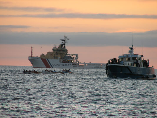
Pilot Gig Races … the little boats under the Coastguard boat … and some cheering fans
There are also avid adult sailors who race several times a week in wooden boats with red sails. There were 20 boats out in the stiff northerly wind when we were in St. Mary’s.
Tresco:
The Duchy of Cornwall leases the entire island to the Dorrien-Smith family who live in Tresco Abbey. The modern abbey was built around the ruins of the 12th century abbey, and has a fantastic garden featuring plants from semi-tropical environments around the world.
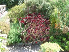
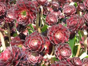
Semi-succulent sedums
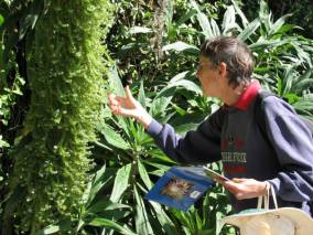
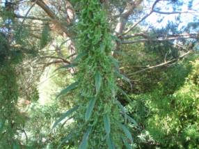
Echium: a most unusual stalk with whorls of blue flowers… and a close-up of it. It grows wild in Cornwall
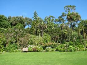
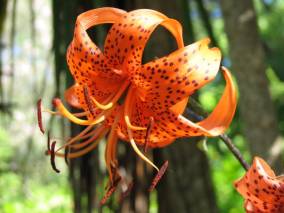
A bench for contemplating the garden …. And a tiger lily to contemplate
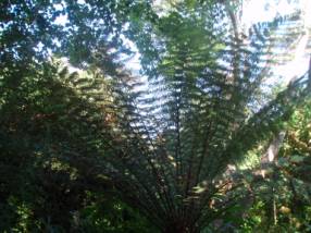
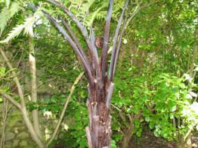
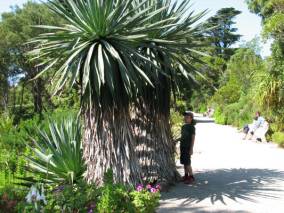
A fern tree and a snail climbing up the stalk


Stairs leading up to Neptune’s statue
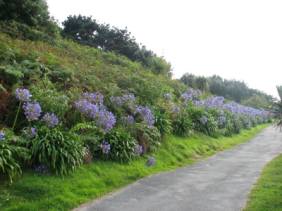
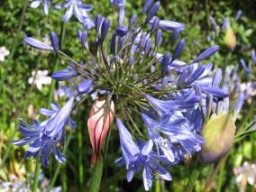
Agapanthus has been naturalized from South Africa
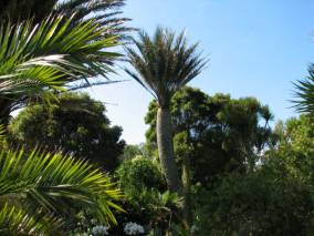
The climate is warm enough for many different palms to thrive
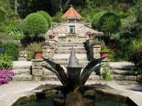

The Mediterranean Garden with Agave fountain Children of Tresco statue by David Wynne
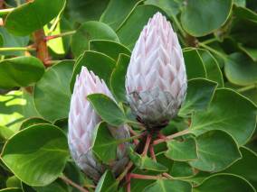
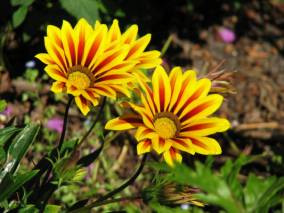
Protea in bud, transplanted from the Western Cape of South Africa … and a flower we cannot identify

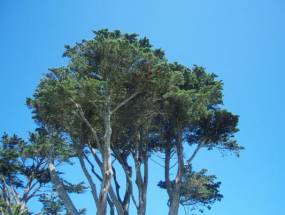
Dalias in bloom Towering evergreens
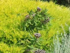
Wild herbs
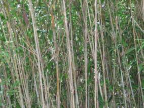
and a stand of bamboo
In addition to sub-tropical plants from around the world, the garden has a museum of ship figureheads.
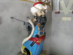
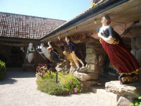
Figureheads from ships sunk off the Scilly Islands … a vast collection from around the world
Just north of New Grimbsy, the main town on the island is St. Nicholas Church. It is a typical small Church of England parish church with a surrounding cemetery. Since St. Nicholas is the patron saint of sailors, we thought it a particularly apt name for the church.
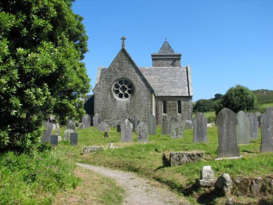
St. Nicholas Church and surrounding graveyard
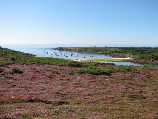
The north end of the island is devoid of trees. The ground is covered with heather and gorse. There are pathways through the ground cover, but anyone could easily walk right over the plants. The heather imparted a sweet odour and attracted honeybees. When standing quietly, it almost sounded like the Indianapolis 500 with the buzzing bees.
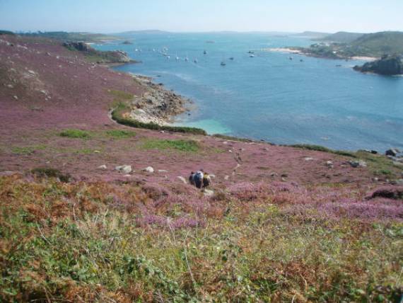
The sweet smell of heather was overpowering but did not cause any allergy problems
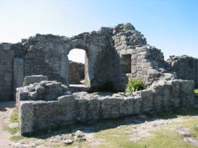
King Charles’ Castle ruins overlooking the Cromwell Castle
King Charles’ Castle was built in 1550 to protect the north coast from invasion by the French and Spanish. It was replaced by Cromwell’s Castle in 1651.
St. Agnes and The Gugh:
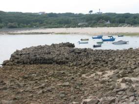
These two islands are joined by a land bridge at low water. The bridge is submerged at high water. It is difficult to get supplies to the Gugh and export farm goods. There are just two farmhouses that have been occupied since 1940. Farming in general is difficult because of the poor soil and the lack of a local veterinarian. There are no trees on the island, but many towering granite rocks.
The land bridge at low water… just wide enough for a tractor or a boatload of tourists
The three “towns” on St. Agnes are Higher Town, Middle Town and Lower Town. Each has a few houses; Middle Town also has a store / post office.
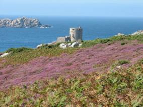
Since St. Agnes is the first landfall a ship encounters riding the prevailing westerly winds, shipwrecks were common and salvage an important supplement to the inhabitant’s income. In the 19th century the island had its own lifeboat station; the crew constituted 10% of the population of the whole island. A grand lighthouse was erected in the centre of the island. It is no longer in use, and never was that effective since it was so far inland. Peninnis Head Lighthouse on St. Mary’s has superseded it.
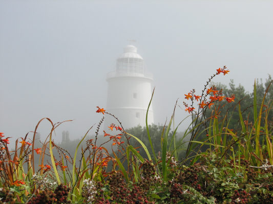
The lighthouse in the fog … no lights and no sound … only useful as a landmark when it’s sunny
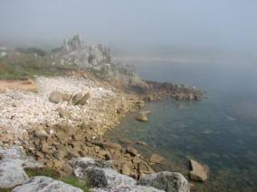
There are many towering granite rocks that sometimes take the shape of an animal (Nag’s Head).
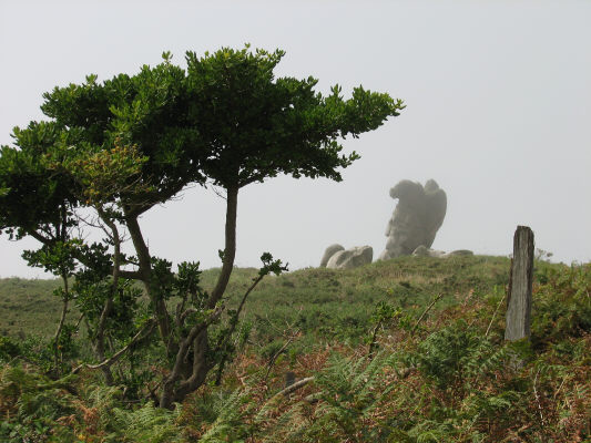
Even in the fog it doesn’t look much like a Nag … maybe some rose coloured glasses would help
St. Warna’s well is thought to be an old Celtic sacred well. Residents used to put offerings into the well to “ease” the passage a ship onto the rocks.
St. Warna’s well … I wonder who collected the money at night … tooth fairy on his night off?
Beady Pool on the southeast tip of the island has a beach awash with Venetian glass beads from a old shipwreck. There is also a labyrinth that was (re)constructed by a lighthouse keeper in the 19th century.
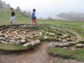
The small labyrinth is marked as a Maze on the tourist maps … hard to find if you expect a Maze