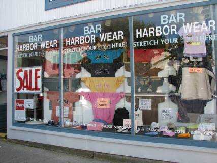
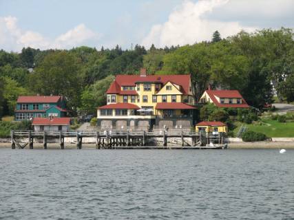
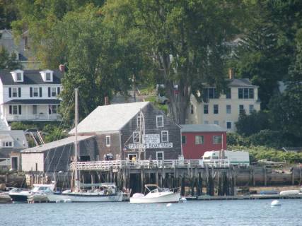
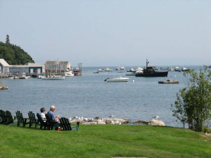
Sunday, September 3, 2006. Bar Harbor. This city reminded us of Charlevoix, Michigan where Jane’s family has a cottage. It is a tourist town complete with a HarborWear Store that advertised outlets in Charlevoix, Harbor Springs, and Petoskey.
Just like back in Charlevoix …
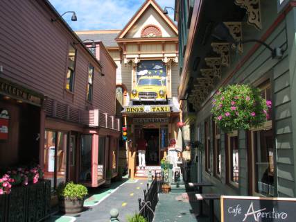
Except they don’t drive cars through houses in Charlevoix
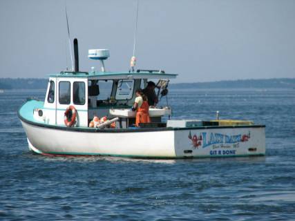
We took a shuttle bus from the Holiday Inn (where our boat was docked) to Bar Harbor. Our bus driver was a woman who is married to a lobster fisherman. We asked her about lobster fishing in this area. She said each fisherman is allowed a certain number of pots (her husband has 500) and that fishing can go on year-round. We told her that in Canada there is a lobster season than varies depending on the area. She said she was aware of the Canadian restrictions and thought there were a good idea; there are no controls on the number of lobsters that are harvested in Maine, and the stocks are getting smaller each year. There are more lobsters harvested in the Canadian Maritimes (New Brunswick, Prince Edward Island and Nova Scotia) than in Maine, and during the Canadian season, the price of lobster in Maine goes down significantly.
The lobster floats are numerous and in water as deep as 400 feet and as shallow as 40 feet. The floats are brighter and generally easier to see in Maine than in Canada.
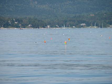
Hard to see in a photo … harder to see in the water …lobster pots
One fisherman had gaily-painted orange and white polka dots on his floats. In the deeper water where there are sea swells, it is difficult to see the floats that sometimes disappear under the surface of the water, especially at high tide.
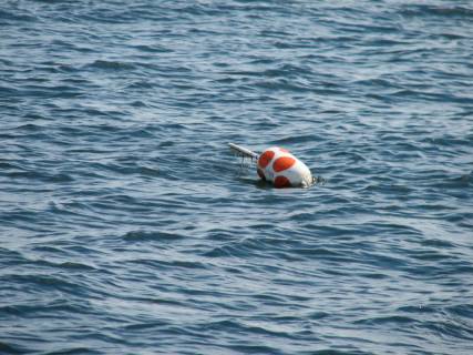
The polka-dot pots … caught our attention … not our prop
The boat that lays the polka-dot traps …
Sometimes, the only thing visible above the water is a small handle on the float that resembles a Popsicle stick. Since the pots rest on the bottom, just think of the amount of rope required to put a float on each pot. Most of them are individually marked; some are on a string with a float at each end.
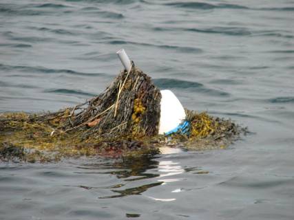
And some pots are camouflaged just in case you were getting bored
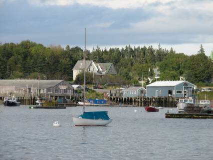
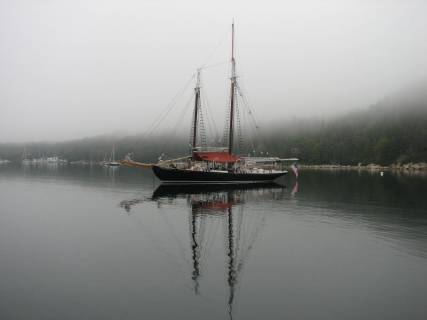
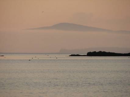
Sorrento Harbor. We were glad to leave the most expensive dock (at $3.00 per foot) since we departed Whitby and had a lovely sail for 5 miles NE to Sorrento. We have discovered that $3.00 per foot is not considered expensive in the US. No wonder people here think that one must be wealthy if they own a boat over 30 feet. Even picking up a mooring ball with few on-shore services is expensive. We anchored just outside the mooring area.
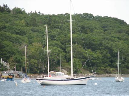
The mooring area we had to stay clear of … in sunlight
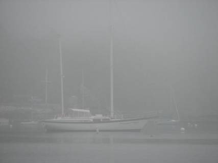
and in an early morning fog
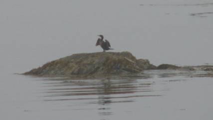
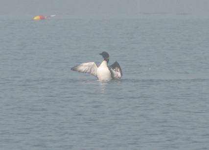
A gentle overnight rain cleaned off the saltwater from our Fundy / Gulf of Maine crossing. After we anchored, one sole loon and some gulls greeted us, including a new gull, the Franklin. It looks very much like a dove: almost all white with some flecks of black and gray on the head. It is very small … smaller than a ring-billed gull.

The Franklin Gull … much cuter than the bird shown below
Yes,
they are everywhere
Monday, September 4, 2006. Little Cranberry Island. This island is south of Mount Desert Island on which Bar Harbor is located. We motored from Sorrento to the Cranberry Islands since there was no wind. We anchored on the outskirts of a large mooring area. The Cranberry Islands were named because of the extensive marshes that bred both cranberries and mosquitoes. In the 1920’s a project drained the marshes. They were successful in killing off the cranberries, but not the mosquitoes.
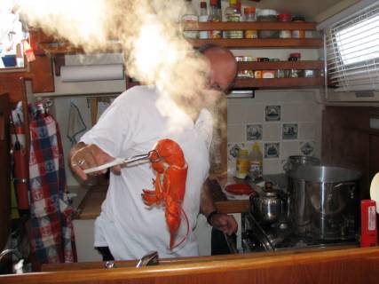
We walked around the “town” Islesford, which has basically closed down now that summer is over. There are a number of very large cottages on the island, but only 14 year-round residents. We bought 4 lobsters at the Little Cranberry Island Fishermen’s Coop at $8.50 per pound. They were excellent, but we thought pricy. One fisherman told us that this is the best time of year to catch lobster. Brian asked what percentage of the traps would have a lobster, and he replied, “Every one usually has at least one lobster and sometimes as many as six.” We think this would include females and undersized lobsters that would be tossed back.
Little Cranberry Island harbour at high tide
Little Cranberry Island lobster in no tide
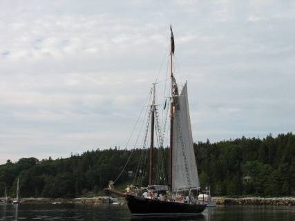
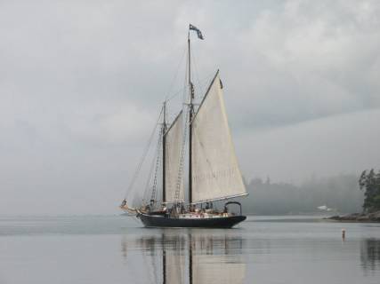
Wednesday, September 5, 2006. Bucks Harbor. We left the Cranberry Islands and motored westward away from Mount Desert Island. A high-pressure area was in the area, which meant very light winds from the west and northwest and sunny skies. We motored through two passages which looked somewhat difficult on the chart but which turned out to be fairly easy since there was so little wind to work against the current. We arrived at the southeastern end of Eggemoggin Reach and had enough wind to hoist our sails to go up the reach. A reach is a passage of water that allows most sailboats to sail in either direction on a reach in prevailing winds. This reach runs southeast to northwest, and the prevailing winds are southwest or northeast. A 44-foot ketch was just behind us, so we sailed together (raced?) as far as we could until the wind gave out. There is a large suspension bridge across the reach (the Rainbow Bridge) and when we approached it, the wind picked up again, so we were able to sail the last couple of miles.
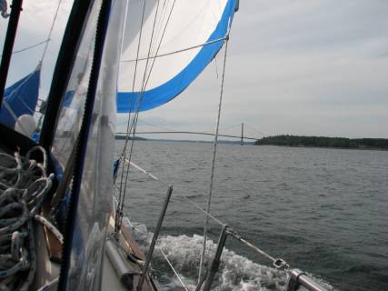
A great sail to the Rainbow Bridge
We anchored near the edge of a large mooring area. An 80-foot schooner (Nathanial Bodwitch) with a gaff rigged main and foresail was anchored close to us. There are a number of large schooners that sail out of Camden (west side of Penobscot Bay), taking passengers for a one-week excursion and teaching them how the old schooners sailed. They are equipped with wooden turning blocks, hemp rope, a manual windless for the anchor, and two large yachtsman anchors (these are the old type of anchor with two hooks that are often drawn on flags and as a symbol for an anchor).
The schooner at anchor … now what is he doing up the mast?
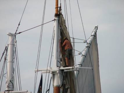
Trying to fix a fouled sail by the looks of it
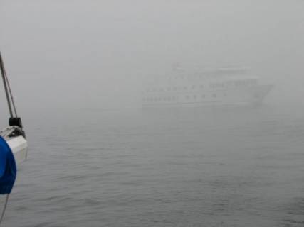
Wednesday, September 6, 2006. Smith Cove. We had just a little bit of rain last night, but we were enveloped in fog this morning. We could not see across the harbour and even some of the nearby boats vanished in the mist. As soon as the fog lifted, 2 of the passengers and 2 crew on the schooner put their shoulders to work on the windlass to bring up the anchor very s-l-o-w-l-y. It was interesting to watch (from a distance).
Nathaniel Bowditch at peace
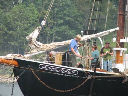
and struggling to get the anchor raised
Another fog bank rolled in just as they left the harbour, so we stayed put for another hour until the fog lifted.
A slow sail into the mist
There was virtually no wind, so we motored the 12 miles to Smith Cove. The “cottages” along the coast are huge. We wonder what the people in the cottages do all summer. They cannot swim; it is much too cold (the water temperature is 60 degrees tops). Many of the cottages have no docks, moorings or dinghy landing sites. We suppose they play tennis and golf and fly-fish in the rivers and inland lakes.
One of few cottages with a dock … I wonder if they share
We are also amazed at the size of the boat, especially sailboats, in Maine. More than half are ketches or yawls (two masts) and are as large or larger than Pilgrim. The powerboats are also large, often in the 50-70 foot range. We expect we will continue to find large boats all down the east coast of the US.
A smaller cottage with a bigger boat … must be a serious sailor
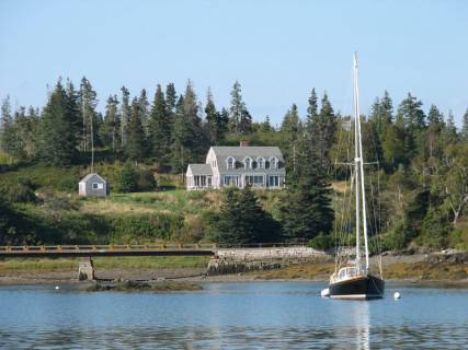
Smith Cove is close to Castine, a small resort town with moorings and dinghy docks, but no place to anchor. The town is on the Bagaduce River, which has a strong current, especially with the full moon and 11 foot tides and anchoring is not recommended. Therefore we anchored in Smith Cove and took the dinghy into town (2 miles away). One of the major features of the town is the Maine Marine Academy (MMA).
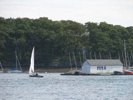
The MMA floating sailing school clubhouse … main buildings are ashore
It offers degrees in maritime subjects (engineering, management, etc), and has a number of boats in the harbour. They have a fleet of 470 sailing dinghies, a small fleet of keel boats (not sure of the design), a schooner (the Bowdoin), and the host of boats owned by the instructors at the academy. Samuel de Champlain and John Smith stopped in Castine in the early 1600’s and it was the location of the British “Fort George” finally turned over to the Yanks after the war of 1812.
Town dinghy docks … and they did not charge a landing fee … will wonders ever cease
There is a very large (110+ foot) motor yacht anchored in the same bight as us. It is registered in London, named Blue Guitar, but the folks who own the boat are not from London. We are trying to figure out what rock star might call his/her boat Blue Guitar. So far all we have seen on board are the 4 paid crew.
Blue Guitar at anchor while her 4 paid crew watch videos
We sailed off our anchor in Smith Cove (a first for us). We had to engine running, but never put it in gear. One of these days we must anchor without using the engine. The wind that allowed us to sail off the anchor did not last long and was in the wrong direction for sailing to Pulpit Harbor. We motor-sailed the 13 miles.
Thursday, September 7, 2006. Pulpit Harbor, Maine. This is one of the prettiest harbours we have seen so far in Maine. It is on the Northwest side of North Haven Island and it almost landlocked. There are a number of mooring balls (and almost all of the visitors have taken up a mooring ball), but there is enough room to anchor in 20 feet of water at low tide. Since the tidal range is 11 feet since the moon is full tonight, we have a full 100 feet of chain out. There is just a whisper of wind and the fog settled down on us at dusk (which happens at 7:00 these days). Another one of the big schooners with a load of passengers is anchored with us tonight. It is the Mercantile and has a huge main boom that overhangs the boat.
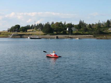
Jane off exploring in her “sports paddle-about”
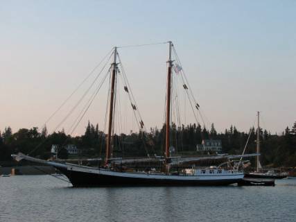
Mercantile at her final anchorage for the week
There was mist on the distant hills, but a mix of sun and cloud overhead; the temperature was a warm 85 degrees, perfect weather for a paddle in the inflatable kayak around the harbour. The fog rolled in at dusk and was so thick overnight we could hear drops of water falling on the cockpit enclosure all night. The fog did not lift until 11:00 on Friday morning.
Fog … makes for very interesting perspectives
Friday & Saturday, September 8 & 9, 2006. Long Cove. There was less than 5 knots of wind from the southwest … the direction to Long Cove. Therefore we motored the entire distance.
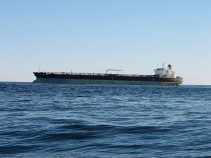
About halfway here (23 miles from Pulpit Harbor) the fog rolled in again. We turned on radar, which helped us identify lobster boats in the vicinity. There were a number of lobster floats, but the surface was not thick with them. But then, we were in 200 – 500 feet of water most of the way. When the fog set upon us, it was hard to see the floats in the foggy glare. Visibility at its worst was less than ¼ mile. A very large ferry (about 150 feet) loomed out of the fog behind us. We heard its deep blast on the horn before we saw it.
There is a very large boat just to the right of the mizzen boom
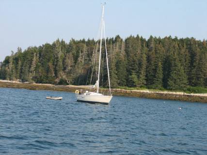
The fog lifted as we approached shore and we had no difficulty seeing our way into the anchorage … nestled between lobster floats. We have anchored close to another sailboat, about 33 feet long, from Bath, Maine. The sole occupant dinghied over to greet us and we had a delightful time with him sharing dinner.
Doug’s boat
A loon in the mists of Long Cove
We stayed at Long Cove, just outside Tenants Harbor for two nights, waiting for the wind to shift to the north for our trip south. We took the dinghy to Tenants Harbor, a very small town that had a fish market / restaurant, a general store, post office, legion hall, and Inn. Most of the town had “closed for the season,” since it was after Labour Day.
Tenants Harbor … a quiet spot for lunch

Tenants Harbor … public dock
Sunday & Monday, September 10 & 11, 2006. Plymouth, Massachusetts.
The trip to Cape Cod Bay was kind of wild. It started out with relatively calm seas and north wind at about 15 knots; perfect for going down the Maine coastline.
At lunchtime when we were about 3 miles from shore, we were inundated with flies. There must have been several hundred on the aft deck and more than 100 were swatted in the cockpit and cabin. Just as in the Great Lakes, once we were far from shore the flies seem to appear. Do they float on the water? We are not sure.
After lunch the wind died, so we motored from 1:30 PM until 1:30 AM.
Then, the wind picked up again from the northeast, first at 12 knots, but
quickly built to 20 knots with 25 knot gusts. We had a reef in the main
and used the staysail instead of the Genoa (which appears to have
jammed). We are really glad we used the staysail. We were doing 7
knots with the small sail, and if the Genoa had jammed open, we would have had
a real mess on our hands. By the time we got into Cape Cod Bay, the seas
were 12 feet. Quite a ride! It was especially difficult as we got
close to Plymouth and encountered lobster floats in the big sea. At least
they were not as thick as in Maine.
This freighter was drifting off Boston … waiting for the
expected winds to pass
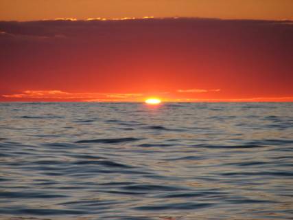
Almost calm conditions but the seas are building … note Red Sky
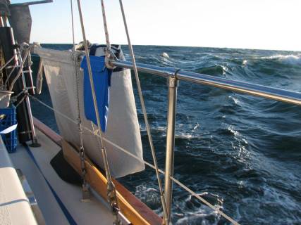
10-12 foot seas from the stern

Arriving at the entrance to Plymouth … 20 knots and 12 foot seas
We arrived at Plymouth just 24 hours after leaving Long Cove. We motored for 12 hours and sailed for
12. The actual harbour area in Plymouth
is a good 5 miles inside a spit of land down a fairly narrow and shallow
channel. We are at the Plymouth Yacht
Club on a mooring ball waiting for Hurricane Florence to make her way up the
coast. We have had two days of 15-20
knot winds from the northeast. We have
taken this time to explore Plymouth (landing spot of the Mayflower and first
home to the Pilgrims, so it is fitting for us to be here).
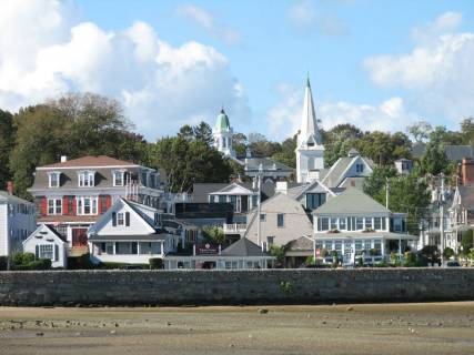
Plymouth town centre taken from Pilgrim’s mooring … low tide
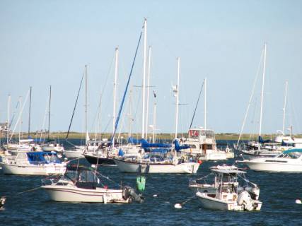
Pilgrim in Plymouth, closely nestled among many other boats
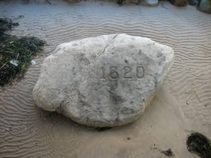
Pilgrim Rock container … a larger version of a Pet Rock
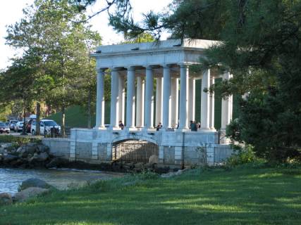
The Rock … Guess the art of graffiti was a bit more puritan back then

Jane after a 2-mile hike … on land
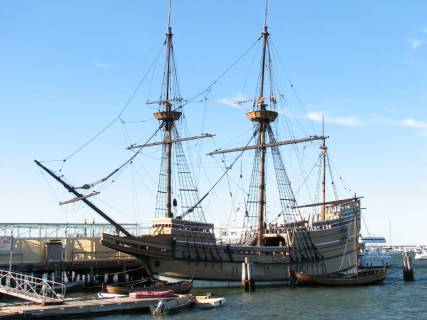
The Mayflower II …I wonder how much it cost to feed the crew …
As soon as the weather calms, we will head down the Cape Cod Canal to Buzzard’s Bay and Long Island Sound. We hope be near Westport Connecticut to see Amelia on or near her birthday, since she is now working there for Save the Children and will probably spend a night in New York City around late next week (around September 21-23).