Wednesday August 10, 2005. Duluth
Wednesday we decided to stay an extra night in Duluth / Superior. The weather was threatening thunderstorms .
Thursday August 11,2005. Cornucopia
Thursday morning we left the harbour via the Superior entrance (we had entered on Monday afternoon at the Duluth entrance with the lift bridge). There was no wind; not even cats paws on the water, so we motored.
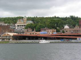
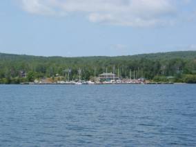
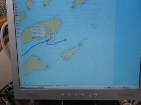
A last view of the Marina and of the City of Duluth
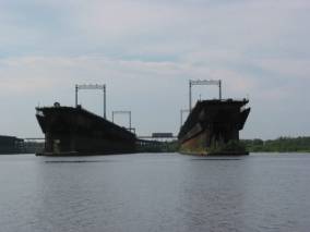

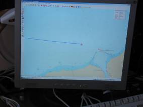
Ship unloading docks and a top view of where we are
The
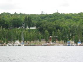
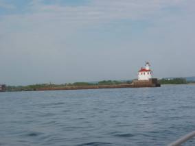
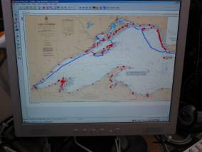
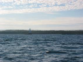
Superior Entry Lighthouse and a view of the trip so far.
Around noon the wind picked up from the Northeast (exactly the direction we were headed), and the waves built up quickly. We tried sailing once the wind increased to 12 knots, but our speed made good was very poor, so we just continued motor-sailing. By 4:00 it was obvious it would be close to dusk if we continued to Sand Island, so we diverted our course to one of two harbours between Duluth and the Apostles (60 nautical miles) called Cornucopia.
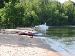
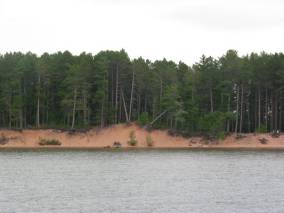
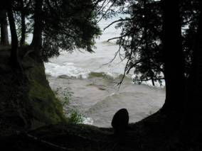
Finally back out in Lake Superior, we had a great sail to Sand Island with a broad reach, topping 7 knots speed. We passed the western-most island in the Apostles, Eagle, which is a wildlife refuge for Herring gulls, cormorants (why???), and blue herons. We rounded the northern tip of Sand Island and sailed down the east side to anchor in East Bay. It has beautiful sand beaches and the water is 70 degrees! We had a difficult time anchoring, however. We tried twice to get a set with our 60 lb. CQR but it just dragged through the sand/stone. The wind was gusting to 23 knots, so there was no need to reverse to attempt to set the anchor. Finally we decided to deploy our trusty Danforth anchor from the bow as a second bow anchor, and it bit immediately. We are in 10 feet of water with 80 feet of rode and a 30 lb kellet on the Danforth plus the 60 lb CQR with 80 feet of chain (we aren’t going anywhere), and have held well through 17-20 knot winds.

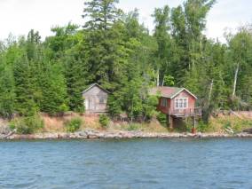
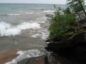
There are some interesting trails leading to the lighthouse on the north end of the island and a sand spit on the sound end. On the NE side there are “caves” that have been eaten away from the sandstone that look fascinating to explore with the dinghy .
Monday, August 15, 2005. Raspberry Island, the Apostle Islands.
Our weather has been glorious the past few days. Warm during the day, cool in the evenings. Southwest winds from 5 to 20 knots, and mainly sunny skies.
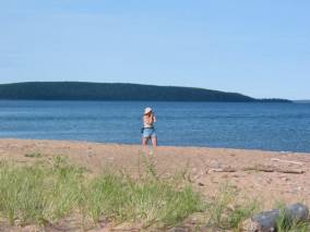
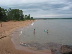
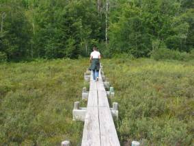
The beach is beautiful sand that is red-brown and quite fine sand. It was fun just wading in the warm shore water. Amelia and I walked to the north tip of the island to visit the lighthouse. The trail was very well marked, absolutely flat, and often a mini-boardwalk because the ground was marshy in places, especially in the spring. It was good to stretch our legs and observe the ferns, wildflowers and hear the birds and squirrels chatter. The thistles bursting into seed were especially pretty.
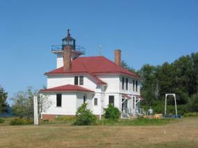
The lighthouse, which is still operational with an automated modern light (visibility only 7 miles) was built in the 1880s from the sandstone (brownstone) of the island. A volunteer ranger took us on a tour and told us about two wrecks that occurred near the light. Originally the light was fired by Kerosene, with a wick through a Fresnel lens. The keepers main duties were to keep the wicks trimmed, haul the Kerosene to keep the light burning, and pull the weights that rotated the lens. The house had a parlor, summer and winter kitchens, 3 bedrooms, wood and food cellars, and an outside privy with 2 adult and 1 child’s seats. We were allowed to go up into the lighthouse and the view of the other islands and the Minnesota shoreline was spectacular.
After our tour we picked as many blueberries as we could until the biting flies drove us away. On our way back to the beach we also picked thimbleberries. They look somewhat like a raspberry and have a taste somewhere between a strawberry and raspberry. They have natural pectin so make wonderful jam, but we could not find enough except as a garnish on our dessert.
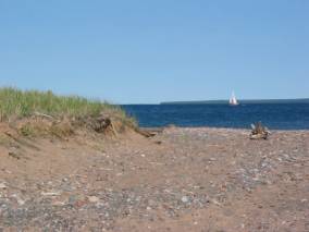
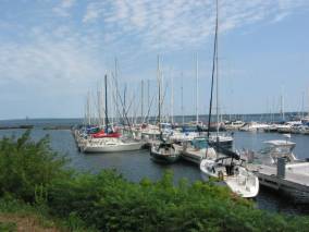
The Apostle Islands are a National Park (not regulated quite as rigorously as Isle Royale) with a number of shallow-draft docks, campgrounds, and volunteer rangers. There are more boats here than we have seen elsewhere in Lake Superior. The Bayfield area is a big sailing / boating / resort area. Many people keep their boats here and spend the weekends in the Apostle Islands. Therefore, there were about 15 other boats in the East Bay of Sand Island on Friday and Saturday nights.
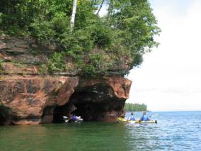
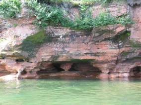
Sunday morning we put the motor on the dinghy and went to Swallow Point (just north of East Bay) where there were sea caves. The Northeast winds (during the Fall) batter this point of land. The landform is a sandstone cliff (not a tall one, just about 100 feet high). The waves from storms have battered the soft sandstone and created cave-like structures that are most fascinating. Moss and cliffbreaks (a kind of fern) grown on the ceilings and walls, and the constant surge runs through the caves creating a deep rumble, like a kettledrum.
We left Sand Island a bit after noon and sailed with just the mizzen in 15 knots of wind from the southwest to Raspberry Island, about 6 miles to the east.
We are anchored on the east side of a sand spit on the SE side of Raspberry Island. The sand spit is home for about 100 Herring Gulls, and all boaters who visit the island feel the need to walk out on the spit, which causes the gulls to scatter into the lake. As with Sand Island, the sand beach is beautiful and fun for leisurely walking / stone collecting. Today we hiked to the Raspberry Island lighthouse. Unfortunately, the grounds and lighthouse are undergoing extensive renovation starting today until 2007, so we wandered through the grounds but were unable to tour the lighthouse. The trail from the sand spit to the lighthouse was another excellent trail with boardwalks and steps built into the hillside. Raspberry Island has a little more height than Sand Island.
Wednesday, August 17, 2005. Presque Isle Bay, Stockton Island, Apostle Islands.
We left Raspberry Island at noon after a downpour of rain (much needed here) and motored the 12 miles to Bayfield. We got a pumpout at the Apostle Island Marina and were assigned a dock.
Then we went to town for groceries and more fly swatters (which we were unable to find at Wal-Mart in Duluth). A boat can never have too many fly swatters. Bayfield is a lovely resort town and reminded us very much of Charlevoix, especially when we saw the HarborWear store on the main street, advertising other locations in Charlevoix, Boyne City, Petosky, etc. The grocery store was a small IGA; no cherries, no green beans, very sad broccoli and tomatoes. Thank goodness we did not need much.
We were able to find a wireless access point that allowed us access to the Internet. This allowed us to check our regular e-mails and see the aerial photo of Raspberry Island on our website. (We really like seeing these photos, and wish we had access to them before anchoring).
This morning we pushed off from our dock and decided to anchor at Stockton Island, one of the eastern islands in the Apostles with a well-protected harbour until the wind clocks to the west. We had wind from the northeast around 8 – 11 knots.
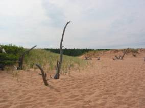
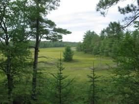
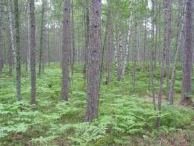
We anchored and then watched a thunderstorm approach and pour rain on us. When the rain stopped (around 2:30), we set out in the dinghy for the docks and found an interesting trail. (We were warned that bears had been sighted recently, but we saw none) Stockton Island used to be two islands. Over time, a sand spit (Tombulo) connected the two. A 4 mile trail was most fascinating, going through hardwood, Boreal and old-growth pine forests, a huge bog (with wild cranberries, pitcher plant and sundews (both insect-eating bog plants) and sandhill cranes, blue herons, many varieties of frogs), sand dunes and sand beach. It was a tiring hike, especially walking on the beach for about 1.5 miles. There are so many ferns, I wish I had brought my fern field guide. Since there are virtually none in the North Channel, I have never thought to bring it on board. We also found blueberries (still can’t believe blueberries in August … the North Channel berries are long gone by the first of August)
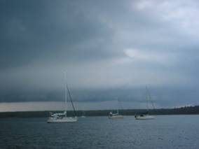
Rowing back to Pilgrim after our hike, the heavens opened up on us again and we were drenched when we got back to the boat. We have both our 60 lb. CQR and our 20 lb. Danforth deployed from the bow, sent for east and southeast winds. Currently we are facing due North! Much lightening, booming thunder, dramatic clouds, and rain (from pitter pat to drenching downpour).
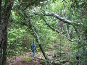
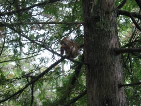
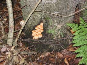
We stayed anchored at Presque Isle Bay on Stockton Island in the Apostles two nights and three days. We enjoyed hiking several of the trails and watching the surf from the strong east wind on Julian Bay on the opposite side of Anderson Point from us. I mentioned the wide variety and abundance of ferns already. On Thursday I was amazed at the number of mushrooms, puffballs and tree fungi we saw. We also stopped long enough to pick a couple of handfuls of blueberries and had blueberry pancakes on Friday morning. While we were walking the Anderson Point trail, Brian stopped to take a picture of the bay in which we were anchored. I noticed bits of a pine cone falling on the ground at my feet and looked up. A red squirrel was sitting on a branch about 6 feet above my head, and was not at all disturbed by my presence or even the flash on Brian’s camera when he approached to photograph the squirrel.
 We
found
out from an official guide to the Apostle Islands that Stockton
Island is
home to about 30 bears, down from a high of 40 a few years ago. The park service
claims it is the highest
density of black bears in the wild in North America.
We
found
out from an official guide to the Apostle Islands that Stockton
Island is
home to about 30 bears, down from a high of 40 a few years ago. The park service
claims it is the highest
density of black bears in the wild in North America.
The trip from the Apostles to the Keweenaw Waterway is 80 nautical miles … about 16 hours if we average 5 knots. We therefore decided to leave Stockton Island at 5:00 PM on Friday and sail through the night. There was still a very lumpy sea from three days of strong east winds, but the wind was very light and predicted to go to the west around midnight. Just as we left, fog rolled in. Thank goodness for Radar.
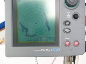
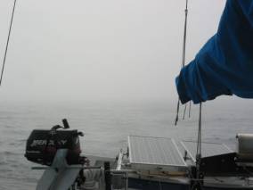
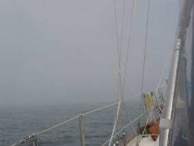
It helped us see boats and land masses half a mile away that were invisible to our eyes. We were thankful the fog lifted before nightfall. The seas were high enough and the wind light enough that motor sailing was the only way we could make any progress. Finally at 2:00 AM the predicted west wind began, and we had a good sail for about 3.5 hours, but then it died to below 8 knots. The sea was confused with east waves meeting the newly formed west waves, and 8 knots of a following wind was just not enough to push us through the waves at a reasonable speed The wind was beginning to build when we passed through the breakwalls, and by the time we made it down to Houghton / Hancock, about 8 miles down the waterway, the wind was steady at 15 knots. There is a lift bridge between the two cities that had to raise for us (our second lift bridge this month). This one is quite large because it used to handle both trains and cars. Now it handles only cars.
We walked across the lift bridge to Houghton and really enjoyed walking along their waterfront. They have put much work into developing it. Some of the old building are being restored and there are some very lovely cottages that are modern reproductions of cottages similar to those on the Belvedere Club. There is a park on a sandy beach with 5-6 very large tube slides (Called Chutes and Ladders) that looked like great fun.